
Time zone CST (UTC-6) Elevation 136 m Zip code 62231 Population 1,717 (2010) | Established November 4, 1873 GNIS feature ID 0429923 Area 74.9 km² Local time Thursday 12:42 PM | |
 | ||
Weather 12°C, Wind NW at 26 km/h, 58% Humidity | ||
Wheatfield Township is one of fifteen townships in Clinton County, Illinois, USA. As of the 2010 census, its population was 1,717 and it contained 713 housing units. The township's name changed from Beaver Township on June 1, 1874.
Contents
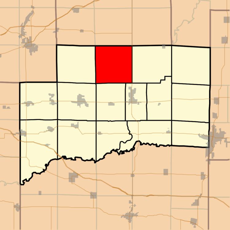
- Map of Wade Township IL USA
- Geography
- Unincorporated towns
- Cemeteries
- School districts
- Political districts
- References
Map of Wade Township, IL, USA
Geography
According to the 2010 census, the township has a total area of 28.9 square miles (75 km2), of which 28.89 square miles (74.8 km2) (or 99.97%) is land and 0.02 square miles (0.052 km2) (or 0.07%) is water.
Unincorporated towns
(This list is based on USGS data and may include former settlements.)
Cemeteries
The township contains these four cemeteries: Rudolph, Saint Felicitas, Saint Peter and Yingst.
School districts
Political districts
References
Wade Township, Clinton County, Illinois Wikipedia(Text) CC BY-SA