
 | ||
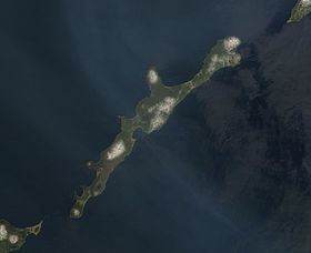
Vries Strait or Miyabe Line is a strait between two main islands of the Kurils. It is located between the northeastern end of the island of Iturup and the southwestern headland of Urup Island, connecting the Sea of Okhotsk on the west with the Pacific Ocean on the east. It has a width of 42 km.
Map of Friz Bay, 694535
The strait is named after Dutch explorer Maarten Gerritsz Vries, the first recorded European to explore the area in 1643.
References
Vries Strait Wikipedia(Text) CC BY-SA