
Area codes 04 Area 27.99 km² Local time Tuesday 11:25 AM | Postal codes 4600-4602 Website www.vise.be Province Liège Area code 04 Team C.S. Visé | |
 | ||
Weather 13°C, Wind N at 6 km/h, 65% Humidity | ||
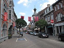
Visé ([vi.ze]; Dutch: Wezet, [ˈʋeːzɛt]) is a municipality and city of Belgium, where it is located on the river Meuse, in the Walloon province of Liège.
Contents
Map of Vise, Belgium
The municipality consists of the former municipalities of Visé, Lanaye (Ternaaien), Lixhe (Lieze), Richelle, Argenteau, and Cheratte.
In the north-east (on the eastern bank of the Meuse river) the area of the municipality extends up to the village of Moelingen in the Limburgian municipality of Voeren, while in the north-west (on the western bank of the Meuse river) it extends up to the border between Belgium and the Netherlands (on the other side of which the Dutch municipality of Maastricht is situated).
The city of Visé is located in a distance of some 20 km (12,4 miles) north eastern of Belgian Liège city and of some 15 km (9,3 miles) southern of the most southern Dutch city of Maastricht.
Apart from the Meuse river another waterway, the Albert Canal, passes through this town.
History
The German armies entered Belgium on 4 August 1914, and entered Visé that day as part of the opening movements of the Battle of Liège. A small group of Belgian gendarmes opposed the advancing Germans and two of their number, Auguste Bouko and Jean-Pierre Thill, were killed in the action becoming the first Belgian casualties of World War I.
Coal mine of Hasard de Cheratte is dug in Cheratte and exploited between 1850 and 1977.