
Time zone Central (CST) (UTC-6) Area code(s) 608 Zip code 54665 | State Wisconsin ZIP codes 54665 Area 9.84 km² Population 4,362 (2010) | |
 | ||
Website www.viroqua-wisconsin.com Weather 7°C, Wind N at 14 km/h, 97% Humidity Points of interest Vernon County Museum, Eckhart Park, LUCY STONE HISTORICAL MARKER | ||
How to say or pronounce usa cities viroqua wisconsin
Viroqua is the county seat of Vernon County, Wisconsin, United States. The population was 4,362 at the 2010 census. The city is in the town of Viroqua.
Contents
- How to say or pronounce usa cities viroqua wisconsin
- Map of Viroqua WI 54665 USA
- History
- Geography
- 2010 census
- 2000 census
- Education
- Economy and revitalization
- Transportation
- Airport
- References
Map of Viroqua, WI 54665, USA
History
The Native American Ho-Chunk inhabited the area now known as Vernon County and the area of Viroqua. The Ho-Chunk, formerly known as the Winnebago, are a Siouan-speaking people who lived in the western Great Lakes region for thousands of years. The Ho-Chunk were removed westward beginning in the 1820s.
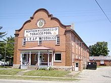
There was a sharp rivalry between Viroqua and Springville to be named the county seat of Vernon County. A deed for 40 acres (160,000 m2) of land was promised by pioneer Moses Decker, on condition that Viroqua be chosen as the county seat. The land constituted what became known as the County Addition to the city of Viroqua.
Decker was one of the early settlers in the area. He arrived in 1847 and laid out the village of Viroqua. He died in 1860. Earlier settlers arrived in 1844 and built lumber mills on the Kickapoo River. Farmers began arriving in 1846, some of whom were John Graham, T.J. Defreese and William C. McMichael.
The town was originally named “Farwell” after Leonard J. Farwell, second Governor of Wisconsin, but was renamed “Viroqua” in 1854. It is unclear why the name was changed, and the origins of the name are unclear. One story states that Viroqua was the name of the daughter of Black Hawk. She may have been a character from a novel or the name of a Mohawk Indian actress who performed in a theater on the East Coast or in Brantford, Canada.
In early 1851, the act authorizing the organization of Bad Axe, now Vernon County, was approved by Governor Nelson Dewey. Viroqua was awarded the county seat, pending a permanent location to be determined by a vote. In May 1852, residents voted in favor of Viroqua.
On June 28, 1865, Viroqua was hit by a deadly tornado that left 22 dead.
Geography
Viroqua is located at 43°33′23″N 90°53′15″W (43.556534, -90.887663). According to the United States Census Bureau, the city has a total area of 3.80 square miles (9.84 km2), all land. The city is in the Driftless Region, near the western end of the Ocooch Mountains.
2010 census
As of the census of 2010, there were 4,362 people, 2,029 households, and 1,059 families residing in the city. The population density was 1,147.9 inhabitants per square mile (443.2/km2). There were 2,208 housing units at an average density of 581.1 per square mile (224.4/km2). The racial makeup of the city was 97.1% White, 0.6% African American, 0.3% Native American, 0.6% Asian, 0.1% Pacific Islander, 0.4% from other races, and 1.0% from two or more races. Hispanic or Latino of any race were 1.0% of the population.
There were 2,029 households of which 25.5% had children under the age of 18 living with them, 39.0% were married couples living together, 10.0% had a female householder with no husband present, 3.2% had a male householder with no wife present, and 47.8% were non-families. 43.1% of all households were made up of individuals and 23% had someone living alone who was 65 years of age or older. The average household size was 2.06 and the average family size was 2.86.
The median age in the city was 45 years. 21.6% of residents were under the age of 18; 6.2% were between the ages of 18 and 24; 22.4% were from 25 to 44; 26.3% were from 45 to 64; and 23.6% were 65 years of age or older. The gender makeup of the city was 46.1% male and 53.9% female.
2000 census
As of the census of 2000, there were 4,335 people, 1,990 households, and 1,112 families residing in the city. The population density was 1,327.3 people per square mile (511.9/km²). There were 2,105 housing units at an average density of 644.5 per square mile (248.5/km²). The racial makeup of the city was 98.73% White, 0.07% Black or African American, 0.16% Native American, 0.46% Asian, 0.18% from other races, and 0.39% from two or more races. 0.69% of the population were Hispanic or Latino of any race.
There were 1,990 households out of which 24.5% had children under the age of 18 living with them, 43.6% were married couples living together, 9.3% had a female householder with no husband present, and 44.1% were non-families. 39.5% of all households were made up of individuals and 22.7% had someone living alone who was 65 years of age or older. The average household size was 2.10 and the average family size was 2.81.
In the city, the population was spread out with 21.4% under the age of 18, 7.5% from 18 to 24, 23.3% from 25 to 44, 21.6% from 45 to 64, and 26.2% who were 65 years of age or older. The median age was 44 years. For every 100 females there were 82.7 males. For every 100 females age 18 and over, there were 77.8 males.
The median income for a household in the city was $28,804, and the median income for a family was $35,475. Males had a median income of $29,589 versus $20,046 for females. The per capita income for the city was $17,172. About 9.8% of families and 12.9% of the population were below the poverty line, including 16.8% of those under age 18 and 12.1% of those age 65 or over.
Education
Economy and revitalization
Viroqua was dubbed "The Town That Beat Walmart" by Smithsonian Magazine in 1992 because it fostered businesses that co-exist with the retail giant. The city promoted small business development through several state and federal programs.
Viroqua is a Wisconsin Main Street City. Its downtown is listed on the Wisconsin and National Register of Historic Places.
The Temple Theatre is an example of the town's resurgence. The US$1.6 million restoration of the 1922 classical revival style vaudeville and movie theater was driven by volunteers. The building now serves as an arts and cultural center for surrounding counties.
Transportation
Viroqua is at the intersection of U.S. Highway 14, U.S. Highway 61, Wisconsin Highway 27, Wisconsin Highway 56, and Wisconsin Highway 82.
Recently, the highways and major streets in Viroqua were redone. Highways 14, 61, and 27 had lanes added to them to become four lanes, except for the four block section of downtown. That was kept two lanes to allow for parallel parking on the side of the road.
Viroqua was on the new airways route between La Crosse, Wisconsin, and Rockford, Illinois, when it was established in June 1932. The beacon light had about 15 large 36-inch (910 mm) revolving beacons of 2,000,000 candle power when it was installed on the Mahlon Lepley farm, four miles (6 km) northeast of Viroqua.
Viroqua is served by the Burlington Northern Santa Fe Northern Transcon route between Chicago and the Pacific Northwest.
Airport
Viroqua is serviced by the Viroqua Municipal Airport (Y51).