
Quadrant NW Sector Mature area Area 51 ha Population 793 (2012) | Ward 7 Elevation 664 m | |
 | ||
Virginia Park is a neighbourhood in north east Edmonton, Alberta, Canada. It is located between the North Saskatchewan River valley to the south and Northlands Park to the north. Its eastern boundary overlooks Wayne Gretzky Drive. Its western boundary is a jagged line running south along the western edge of Borden Park (78 Street), then east along 112 Avenue, then south along 76 Street to the river valley.
Contents
Map of Virginia Park, Edmonton, AB, Canada
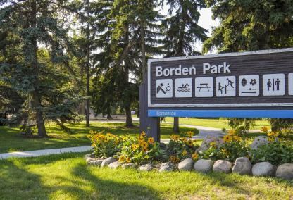
Two notable features of the neighbourhood are Borden Park and Concordia University College
In addition to Concordia University College, Concordia High School and Virginia Park Elementary School are also located in Virginia Park.
The area was originally subdivided prior to World War I, however, three out of four private dwellings data from after the end of World War II. Most dwellings are either walk-up apartments in buildings with fewer than five stories or single-family dwellings. While a large number of single-family dwellings are owner-occupied, over 50% of the residences in Virginia Park are rented.
Demographics
In the City of Edmonton's 2012 municipal census, Virginia Park had a population of 793 living in 451 dwellings, a 6.6% change from its 2009 population of 744. With a land area of 0.51 km2 (0.20 sq mi), it had a population density of 1,554.9 people/km2 in 2012.