
Country Peru Founded January 2, 1857 Time zone PET (UTC-5) Elevation 2,650 m Province La Convención Province | Region Cusco Capital Vilcabamba UBIGEO 080909 Area 5,046 km² | |
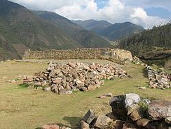 | ||
Vilcabamba District is one of eleven districts of the La Convención Province in the Cusco Region in Peru.
Contents
Map of Vilcabamba, Peru
Geography
The Willkapampa mountain range traverses the district. Some of the highest peaks of the district are listed below:
The Apurímac River is the natural border between the Vilcabamba District and the Ayacucho Region. Within in the district it receives waters from Hatun Wayq'u.
Ethnic groups
The people in the district are mainly indigenous citizens of Quechua descent. Quechua is the language which the majority of the population (64.81%) learnt to speak in childhood, 34.53% of the residents started speaking using the Spanish language (2007 Peru Census).
References
Vilcabamba District, La Convención Wikipedia(Text) CC BY-SA