
Founded 18th Century Elevation 1 m Population 15,750 (2005) | Quarter Vieux Fort Quarter Named for A nearby fort Local time Monday 2:31 AM Area code 758 | |
 | ||
Weather 27°C, Wind E at 29 km/h, 80% Humidity Colleges and Universities International American University College of Medicine, Spartan Health Sciences University Points of interest Sandy Beach, Moule a Chique, Anse Des Sables Beach | ||
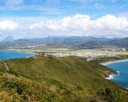
Vieux Fort is a town located near the southernmost point of Saint Lucia, a Caribbean island. It is named after a fort that used to watch out towards Saint Vincent towards the south. The population is about 4,500, while the surrounding district of Vieux Fort Quarter has a total population of about 16,000.
Map of Vieux Fort, Saint Lucia
In the 18th and 19th Centuries it used to be an important centre of the sugar industry in Saint Lucia before that industry declined. During World War II the Americans constructed an airfield called Beane Army Airfield. After the war it was subsequently expanded to form Hewanorra International Airport.
Today, Vieux Fort is the main point of entry for Saint Lucia and also hosts a port just to the south of the town. It is also a major industrial area and also hosts other places such as St Jude's Hospital and the George Odlum Stadium.