 | ||
Victoria Street is a street in Sydney, Australia, which goes through the suburbs of Darlinghurst, Potts Point and the locality of Kings Cross. It is 1.6 kilometres in length.
Contents
Map of Victoria St, New South Wales, Australia
Description
At its southern end, Victoria Street starts at Oxford Street, Darlinghurst. It goes north through the locality of Kings Cross, where it forms a large intersection with Darlinghurst Road. Further north, it continues through Potts Point to terminate at Grantham Street, above Woolloomooloo Bay. The street is a mixture of residential and commercial buildings, with a number of old, Victorian homes that have been converted to backpackers' hostels. Between Earl Street and Grantham Street, Potts Point, the buildings on both sides of the street are heritage-listed.
Points of interest
This park is situated at the far northern end of the street and was constructed on the roof of the Defence Forces car-park in Cowper Wharf Roadway. It provides the locals with some breathing space, with harbour views.
Roughly opposite Embarkation Park, there is a terrace of homes designed in the Federation Filigree style, using woodwork instead of the more usual wrought iron. They are an unusual sight in Sydney, where terraced homes are almost invariably designed in Victorian styles.
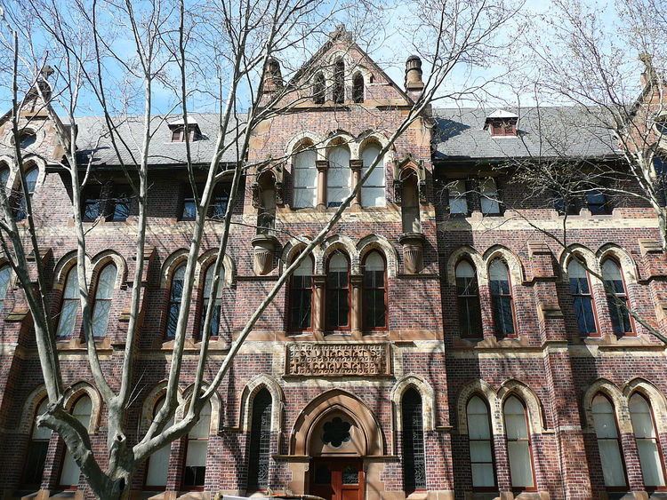
This college is situated on the corner of Victoria Street and Challis Avenue. It was founded in 1858 by Irish Sisters of Charity and was known as the Victoria Street Roman Catholic School. Its cluster of brick buildings makes a distinctive landmark.
These three sets of stairs are located on the west side of the street and provide access to the Woolloomooloo area. They are all heritage-listed.
Situated at the intersection of Victoria Street and Darlinghurst Road, this station was designed by the Government Architect, Walter Liberty Vernon, in the Federation Free Style, utilising a familiar combination of brick and sandstone.
This church was completed in 1858, with nave and aisles designed by J.F.Hilly. Many later additions were designed by Edmund Blacket. The church is heritage-listed. The rectory was designed by J.F.Hilly and built circa 1858, and is also heritage-listed.
Immediately south of the church, this is a drop-in centre run by St John's Church and staffed by volunteers.
This hotel was built in 1893 of red brick and was largely influenced by the Federation Queen Anne style, with some Free Classical details.
This landmark hospital was founded in 1857 by the Sisters of Charity. It was originally located at the site of St Vincent's College, but was later moved to Darlinghurst. The main hospital building was designed by Wardell and Denning in the Inter-War Free Classical Style and built in 1921. It has been described as having "Therapeutic verandas integrated into free classical colonnades." The Sacred Heart Hospice, located on the opposite side of the street, was founded in 1890.
This park is located opposite the hospital, occupying a site between Victoria Street and Darlinghurst Road.
