
Major cities Rome | ||
 | ||
Similar Campo de' Fiori, Palazzo Farnese, Largo di Torre Argentina, Piazza Navona, Celio | ||
Via Giulia is a street in the historic centre of Rome, Italy, mostly in rione Regola, although its northern part belongs to rione Ponte. It was one of the first important urban planning projects in Renaissance Rome.
Map of Via Giulia, 00186 Roma, Italy
Via Giulia was designed by Pope Julius II but the original plan was only partially carried out. This was the first attempt since Antiquity to pierce a new thoroughfare through the heart of Rome and the first European example since Antiquity of urban renewal. Via Giulia runs from the Ponte Sisto to the church of San Giovanni dei Fiorentini, following the tight curve of the Tiber. It became the most fashionable street for new construction for borghesi and for the Florentine community in the sixteenth century. Today its modest structures provide one of Rome's elite shopping streets, noted for its antique shops.
The Via Giulia runs for a full kilometer in a straight line, an innovative feature easily taken for granted today. Its story begins in 1508, as an aspect of Julius' wide-reaching program for the renovation of Rome and the founding of an absolute monarchy in the Papal States, which would assume its rightful place among the European powers. His financial reforms had been undertaken from the first year of his pontificate, and to free the Papacy from its dependence on the great Roman families, he turned to Tuscan bankers outside the circuits either of the Orsini or the Colonna, notably to Agostino Chigi, recently of Siena. A part of Julius' overall plan was the reorganization of the medieval city of Rome, whose unrealized assets were becoming apparent as the renewed city grew in economic importance, recovering from the sleepy backwater it had become during the fourteenth century.
The new street was intended as an artery connecting all the governmental institutions, which were crowded in the single section: the Palazzo della Cancelleria, being completed at that very moment, the papal mint and the projected Palazzo dei Tribunali.
The laying-out of the street was placed in the hands of Donato Bramante, who was in charge of the works at the new Basilica of Saint Peter, taking shape on the other side of the river. Vasari states, "The pope was determined to place in Strada Giulia, which was under Bramante's direction, all the offices and administrative seats of power of Rome in one place, for the convenience of those who had business to do there, having been until then constantly much inconvenienced.
At the same time the new artery linked the river port of the Ripa Grande with the new Via della Lungara, and by the Via Giulia to the Ponte Sisto, in order to bring merchandise securely and conveniently to the heart of the marketing and banking zone.
Work was halted on Bramante's majestic Palazzo dei Tribunali, which was to have assembled under one roof all the judicature of Rome. It remained half-built for a generation, to the regret of artists like Vasari. With this an essential element in Julius' urbanistic project was lost.
The street developed as a line of modest houses with gardens behind them, built for private owners or confraternities, sometimes on speculation, broken by more ambitious palazzi. This is the urban context of the "houses of Raphael", with their ground floor street-front shops.
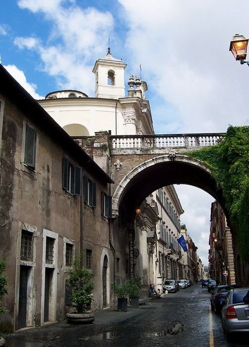
The grand palazzi turned their backs to Via Giulia. In the 1540s Michelangelo had a plan for the constricted gardens of Palazzo Farnese to be connected by a bridge to the Farnese villa in Trastevere on the right bank, Villa Farnesina. The elegant arch still spanning Via Giulia belongs to this other grand unrealized scheme.