
Time zone IST (UTC+5:30) Local time Sunday 4:07 PM | Sub-district Salcete Postcode 403722 Area code 0832 | |
 | ||
Weather 33°C, Wind W at 18 km/h, 63% Humidity University Padre Conceicao College of Engineering | ||
Holy cross church verna goa
Verna is a village in Salcete, Goa, India, adjacent to the village of Nagoa. It is located approximately 10 km north of the South Goa district headquarters Margão, 18 km south-east of Vasco da Gama and 23 km south-east of the state capital Panjim.
Contents
Map of Verna, Goa
Geography
Verna is located in Salcete, South Goa. Its geographical coordinates are 15°20′57″N 73°55′53″E.
Education
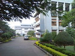
The Padre Conceição College of Engineering (PCCE) is a private engineering college in Verna. The college is a part of Agnel Technical Education Complex, Verna, Goa and is the first private engineering college in the state.
Places of worship
Airports
Airports nearest to Verna; sorted by the distance to the airport from the city centre.
References
Verna, Goa Wikipedia(Text) CC BY-SA