
Population 103 (2011 census) State electorate(s) Macquarie Fields Postal code 2566 | Postcode(s) 2566 | |
 | ||
Location 46 km (29 mi) south-west of Sydney CBD | ||
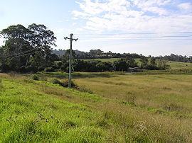
Varroville is a suburb of Sydney, in the state of New South Wales, Australia. Varroville is located 46 kilometres south-west of the Sydney central business district, in the local government area of the City of Campbelltown and is part of the Macarthur region. Varroville forms part of the scenic hills on the north-west side of the M5 South Western Motorway between Campbelltown and the Camden Valley Way. Of all Sydney suburbs, Varroville has the highest proportion of residents with PhDs.
Contents
Map of Varroville NSW 2566, Australia
History
Varroville was originally a farm called Varro Ville. An area of 1,000 acres (4 km2) of land was granted by Governor Lachlan Macquarie to Robert Townson, a scientist and scholar, in 1809. Townson developed the farm and grew a vineyard and raised cattle. Townson died in 1827 and ownership passed onto Thomas Wills the brother of Sarah Redfern wife of William Redfern. In 1837 the farm was sold to Charles Sturt a famous explorer who moved in from Mittagong. James Raymond took over in 1839. Alfred Cheeke, a supreme court judge was a later owner. By 1900 Varro Ville was a leading dairy farm in the Campbelltown area. The farmhouse fell into disrepair, but has been restored by the new owners and the National Trust. The Central Hills Scenic Protection Lands was created in April 1972 to preserve the land use in the area. Campbelltown Council has refused small block subdivisions. The name Varroville was officially adopted in 1972 for the area between Raby and Denham Court. The area was previously part of Minto.
Landmarks
The Mount Carmel Novitiate was built in 1966, while Mount Carmel High School opened in 1986.
Sport
Kooringa Reserve is located directly across the road from Mount Carmel High School. This is the home ground to the St Mary's Eagle Vale Soccer Club the largest soccer club in the Macarthur District.
Transport
The main road in Varroville is St Andrews Road. This was originally a dirt track, skirting St Andrews farm, owned by Andrew Thompson. Other roads named after saints are St James and St David.