
Founded December 7, 1836 Congressional district 2nd Website vanburencoia.org Population 7,436 (2013) Largest city Keosauqua | Named for Martin Van Buren Time zone Central: UTC-6/-5 Area 1,272 km² County seat Keosauqua Unemployment rate 3.6% (Apr 2015) | |
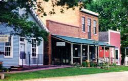 | ||
Cities Keosauqua, Bonaparte, Farmington, Cantril, Stockport, Birmingham, Milton Rivers Des Moines River, Fox River, Rock Creek, Holcomb Creek | ||
Van Buren County is a county located in the U.S. state of Iowa. As of the 2010 census, the population was 7,570. The county seat is Keosauqua, which contains the oldest continuously operational courthouse in the state of Iowa, and second oldest in the United States.
Contents
- Map of Van Buren County IA USA
- History
- Geography
- Major highways
- Adjacent counties
- 2010 census
- Census designated places
- Unincorporated communities
- Townships
- Population ranking
- References
Map of Van Buren County, IA, USA
History
Van Buren County was formed on December 7, 1836 as a part of Wisconsin Territory, and was split off from Des Moines County. It was named for President Martin Van Buren. It became a part of Iowa Territory (later the state of Iowa) when that territory was organized on July 4, 1838.
The county's courthouse was built in September 1843 in the style of Greek Revival and stands as Iowa's oldest, and the nation's second oldest, courthouse in operation.
Geography
According to the U.S. Census Bureau, the county has a total area of 491 square miles (1,270 km2), of which 485 square miles (1,260 km2) is land and 5.7 square miles (15 km2) (1.2%) is water.
Major highways
Adjacent counties
2010 census
As of the census of 2010, there were 7,570 people, 3,108 households, and 2,058 families residing in the county. The population density was 15.614/sq mi (6.029/km2) people per square mile. There were 3,670 housing units at an average density of 7.570/sq mi (2.923/km2) per square mile. The racial makeup of the county was 98.3% White, 0.2% Black or African American, 0.1% Native American, 0.5% Asian, 0.2% from other races, and 0.7% from two or more races. 1.2% of the population were Hispanic or Latino of any race.
There were 3,108 households out of which 25.4% had children under the age of 18 living with them, 55.4% were married couples living together, 7.0% had a female householder with no husband present, and 33.8% were non-families. 27.7% of all households were made up of individuals and 33.6% had someone living alone who was 65 years of age or older. The average household size was 2.40 and the average family size was 2.97.
In the county, the population was spread out with 24.1% under the age of 18 and 19.8% who were 65 years of age or older. The median age was 43.3 years. For every 100 females there were 100.6 males.
As of the 2000 census, the median income for a household in the county was $31,094, and the median income for a family was $36,420. Males had a median income of $27,379 versus $20,925 for females. The per capita income for the county was $15,748. About 8.70% of families and 12.70% of the population were below the poverty line, including 14.00% of those under age 18 and 15.60% of those age 65 or over.
Census-designated places
Unincorporated communities
Townships
According to the 1850 US Census Records.
Population ranking
The population ranking of the following table is based on the 2010 census of Van Buren County.
† county seat