
District Třebíč Area 13.33 km² | Postal code 674 01 Elevation 478 m | |
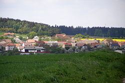 | ||
Výčapy is a village and municipality (obec) in Třebíč District in the Vysočina Region of the Czech Republic.
Map of V%C3%BD%C4%8Dapy, Czechia
The municipality covers an area of 13.33 square kilometres (5.15 sq mi), and has a population of 854.
Výčapy lies approximately 9 kilometres (6 mi) south of Třebíč, 35 km (22 mi) south-east of Jihlava, and 149 km (93 mi) south-east of Prague.
References
Výčapy Wikipedia(Text) CC BY-SA