
Country Japan District Shimoina Area 43.43 km² Local time Monday 11:53 AM Prefecture Nagano Prefecture | Region Chūbu (Kōshin'etsu) Phone number 0260-28-2311 Population 605 (Oct 2016) Bird Japanese robin | |
 | ||
Time zone Japan Standard Time (UTC+9) Address 968-1, Urugi-mura, Shimoina-gun, Nagano-ken 399-1601 Weather 8°C, Wind W at 14 km/h, 51% Humidity | ||
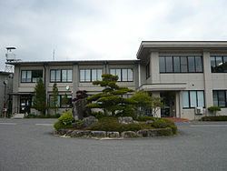
Urugi (売木村, Urugi-mura) is a village located in Shimoina District in southern Nagano Prefecture, in the Chūbu region of Japan. As of 1 October 2016, the village had an estimated population of 605 and a population density of 13.9 persons per km². Its total area was 43.43 square kilometres (16.77 sq mi).
Contents
- Map of Urugi Shimoina District Nagano Prefecture 399 1601 Japan
- Geography
- Surrounding municipalities
- History
- Education
- Railway
- Highway
- References
Map of Urugi, Shimoina District, Nagano Prefecture 399-1601, Japan
Geography
Urugi is located mountainous southern border of Nagano Prefecture with Aichi Prefecture.
Surrounding municipalities
History
The area of present-day Urugi was part of ancient Shinano Province. The village of Toyo was established on April 1, 1889 with the establishment of the municipalities system. Toyo Village dissolved on July 1, 1948, with a portion annexed by neighboring Anan, and the remainder becoming the village of Urugi.
Education
Urugi has one public elementary school and one public middle school operated by the village government. The village does not have a high school.