
City Saitama Phone number 048-835-3156 Population 155,022 (Feb 2016) | Region Kanto Area 11.51 km² | |
 | ||
Time zone Japan Standard Time (UTC+9) | ||
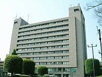
Urawa (浦和区, Urawa-ku) is one of ten wards of the city of Saitama, in Saitama Prefecture, Japan, and is located in the northeastern part of the city. As of 1 February 2016, the ward had an estimated population of 155,022 and a population density of 13,470 persons per km². Its total area was 11.51 square kilometres (4.44 sq mi). Urawa-ku is the governmental center of Saitama City and houses most of the city's administrative offices including the city hall, as well as the offices of Saitama Prefectural government. Also, there are several newspaper branch offices and three broadcasting stations.
Contents
- Map of Urawa Ward Saitama Saitama Prefecture Japan
- Geography
- Neighboring Municipalities
- History
- Education
- Railway
- Highway
- Local attractions
- References
Map of Urawa Ward, Saitama, Saitama Prefecture, Japan
Geography
Urawa Ward is within the Ōmiya Terrace of the Kantō plain, in the south-central portion of Saitama City.
Neighboring Municipalities
Urawa-ku is surrounded by Midori-ku (to the east), Minami-ku (south), Chūō-ku (west), Ōmiya-ku (north), and Minuma-ku (northeast) of Saitama city.
History
In the Edo period, Urawa-ku flourished as Urawa-shuku, a post station on the Nakasendō highway, which connected Edo with Kyoto. Following the Meiji restoration, Urawa Prefecture was established, and in 1871 merged with Iwatsuki, Urawa, and Oshi Prefectures merged to form Saitama Prefecture, and Urawa as the capital. The modern town of Urawa was officially created within Kitaadachi District, Saitama with the establishment of the municipalities system on April 1, 1889.
After the 1923 Great Kantō earthquake many intellectuals, especially painters, moved to Urawa from Tokyo, Yokohama, and other cities in southern Kantō region. In 1932, Urawa annexed the neighboring villages of Yada and Kisaki, and was elevated to city status on February 11, 1934. Urawa expanded further by annexing the villages of Omagi and Mimuro on April 17, 1940 and town of Mutsuji on April 1, 1942. During World War II, Urawa was bombed twice by Allied forces in April and May 1945.
Urawa continued to expand after the end of the war, absorbing the villages of Tsuchiai and Okubo on January 1, 1955 and part of the town of Toda on April 1, 1959 and part of the village of Misono on May 1, 1962.
On May 1, 2001 Urawa merged with Ōmiya and Yono to form Saitama City. In April 2003 Saitama became a city designated by government ordinance, and now the area of former Urawa City was divided between Sakura-ku, Urawa-ku, Minami-ku, and Midori-ku.