
OS grid reference SU372169 Post town Southampton Dialling code 023 | Sovereign state United Kingdom Postcode district SO16 | |
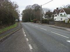 | ||
Upton is a hamlet in Hampshire, England, located approximately 1 mile north of Nursling.
Map of Upton, Southampton, UK
It lies beside the main Romsey Road (A3057) leading north from Shirley as it rises over Horns Hill. In the 19th century the hamlet consisted of one or two cottages and a smithy, as well as country house known as Upton House. The housing development of Upton Crescent was built in the 1930s on the site of the former Upton House. The hamlet is near the starting point of the M271 motorway.
References
Upton, south Test Valley Wikipedia(Text) CC BY-SA