
Country United States County Cumberland Time zone Eastern (EST) (UTC-5) Area 81 km² Population 7,556 (2000) | Incorporated April 3, 1922 Elevation 34 m Local time Sunday 1:14 PM | |
 | ||
Area rank 83rd of 566 in state8th of 14 in county Weather 15°C, Wind NW at 16 km/h, 39% Humidity | ||
Upper Deerfield Township is a township in Cumberland County, New Jersey, United States. It is part of the Vineland-Millville-Bridgeton Primary Metropolitan Statistical Area for statistical purposes. As of the 2010 United States Census, the township's population was 7,660, reflecting an increase of 104 (+1.4%) from the 7,556 counted in the 2000 Census, which had in turn increased by 629 (+9.1%) from the 6,927 counted in the 1990 Census.
Contents
- Map of Upper Deerfield Township NJ USA
- Geography
- Census 2010
- Census 2000
- Parks and recreation
- Local government
- Federal state and county representation
- Politics
- Education
- Roads and highways
- Public transportation
- Notable people
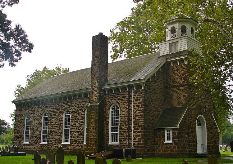
- Points of interest
- References
Map of Upper Deerfield Township, NJ, USA
Upper Deerfield Township was incorporated as a township by an act of the New Jersey Legislature on February 23, 1922, from portions of Deerfield Township, based on the results of a referendum held on April 3, 1922. The township was named for Deerfield Township, which in turn was named for Deerfield, Massachusetts.
It is a dry town, where alcohol cannot be sold, as affirmed by a referendum passed in 1972. Upper Deerfield does not have its own police force.
Geography
According to the United States Census Bureau, the township had a total area of 31.275 square miles (81.002 km2), including 31.098 square miles (80.543 km2) of land and 0.177 square miles (0.458 km2) of water (0.57%).
Seabrook Farms (2010 population of 1,484) is a unincorporated community and census-designated place (CDP) located within Upper Deerfield Township.
The township borders Hopewell Township, Bridgeton, Fairfield Township, Deerfield Township, and Salem County.
Census 2010
As of the census of 2010, there were 7,660 people, 2,866 households, and 2,104 families residing in the township. The population density was 246.3 per square mile (95.1/km2). There were 3,025 housing units at an average density of 97.3 per square mile (37.6/km2). The racial makeup of the township was 74.67% (5,720) White, 12.96% (993) Black or African American, 1.27% (97) Native American, 2.65% (203) Asian, 0.00% (0) Pacific Islander, 5.38% (412) from other races, and 3.07% (235) from two or more races. [[Hispanic (U.S. Census)|Hispanic or Latino of any race were 9.43% (722) of the population.
There were 2,866 households out of which 28.4% had children under the age of 18 living with them, 53.9% were married couples living together, 15.3% had a female householder with no husband present, and 26.6% were non-families. 22.1% of all households were made up of individuals, and 10.9% had someone living alone who was 65 years of age or older. The average household size was 2.65 and the average family size was 3.08.
In the township, the population was spread out with 23.5% under the age of 18, 8.2% from 18 to 24, 23.2% from 25 to 44, 28.8% from 45 to 64, and 16.4% who were 65 years of age or older. The median age was 41.2 years. For every 100 females there were 93.0 males. For every 100 females ages 18 and old there were 89.6 males.
The Census Bureau's 2006-2010 American Community Survey showed that (in 2010 inflation-adjusted dollars) median household income was $53,646 (with a margin of error of +/- $6,771) and the median family income was $61,974 (+/- $9,964). Males had a median income of $45,532 (+/- $5,633) versus $36,741 (+/- $10,855) for females. The per capita income for the borough was $26,033 (+/- $2,581). About 8.9% of families and 12.4% of the population were below the poverty line, including 18.0% of those under age 18 and 4.8% of those age 65 or over.
Census 2000
As of the 2000 United States Census there were 7,556 people, 2,757 households, and 2,125 families residing in the township. The population density was 242.9 people per square mile (93.8/km²). There were 2,881 housing units at an average density of 92.6 per square mile (35.8/km²). The racial makeup of the township was 75.77% White, 16.41% African American, 0.81% Native American, 3.06% Asian, 0.01% Pacific Islander, 1.83% from other races, and 2.12% from two or more races. Hispanic or Latino of any race were 4.54% of the population.
There were 2,757 households out of which 35.8% had children under the age of 18 living with them, 57.1% were married couples living together, 15.6% had a female householder with no husband present, and 22.9% were non-families. 20.0% of all households were made up of individuals and 10.4% had someone living alone who was 65 years of age or older. The average household size was 2.73 and the average family size was 3.12.
In the township the population was spread out with 27.8% under the age of 18, 7.4% from 18 to 24, 25.5% from 25 to 44, 25.1% from 45 to 64, and 14.2% who were 65 years of age or older. The median age was 38 years. For every 100 females there were 94.1 males. For every 100 females age 18 and over, there were 87.5 males.
The median income for a household in the township was $47,861, and the median income for a family was $51,472. Males had a median income of $37,064 versus $23,719 for females. The per capita income for the township was $18,884. About 10.1% of families and 13.7% of the population were below the poverty line, including 23.2% of those under age 18 and 10.8% of those age 65 or over.
Parks and recreation
Sunset Lake is a reservoir located primarily in Hopewell Township and Upper Deerfield Township that was created by damming a stream that feeds to the area from Seeley Lake.
Local government
Upper Deerfield Township is governed under the Township form of government. The five-member Township Committee is elected at-large directly by the voters in partisan elections to serve three-year terms of office on a staggered basis, with either one or seats coming up for election each year as part of the November general election. At an annual reorganization meeting, the Township Committee selects one of its members to serve as Mayor and another as Deputy Mayor.
As of 2016, members of the Upper Deerfield Township Committee are Mayor James P. Crilley (R, term on committee ends December 31, 2017; term as mayor ends 2016), Deputy Mayor John T. "Terry" O'Neill Sr. (D, term on committee ends 2018; term as deputy mayor ends 2016), John L. Daddario (R, 2016), Bruce T. Peterson (D, 2016) and Scott R. Smith (R, 2018).
Federal, state and county representation
Upper Deerfield Township is located in the 2nd Congressional District and is part of New Jersey's 3rd state legislative district.
New Jersey's Second Congressional District is represented by Frank LoBiondo (R, Ventnor City). New Jersey is represented in the United States Senate by Cory Booker (D, Newark, term ends 2021) and Bob Menendez (D, Paramus, 2019).
For the 2016–2017 session (Senate, General Assembly), the 3rd Legislative District of the New Jersey Legislature is represented in the State Senate by Stephen M. Sweeney (D, West Deptford Township) and in the General Assembly by John J. Burzichelli (D, Paulsboro) and Adam Taliaferro (D, Woolwich Township). The Governor of New Jersey is Chris Christie (R, Mendham Township). The Lieutenant Governor of New Jersey is Kim Guadagno (R, Monmouth Beach).
Cumberland County is governed by a seven-member Board of Chosen Freeholders, who are elected at-large in partisan elections to serve staggered three-year terms in office, with two or three seats coming up for election each year. At an annual reorganization meeting held each January, the freeholders select one member to serve as Freeholder Director and another as Deputy Director. As of 2014, Cumberland County's Freeholders (with committee liaison assignments, political party, residence and term-end dates listed in parentheses) are Freeholder Director Joseph Derella (Administration / Public Safety; D, Millville, term ends December 31, 2015), Freeholder Deputy Director Douglas M. Long (NA; D, Upper Deerfield Township, 2015), Darlene Barber (Education; D, 2016, Upper Deerfield Township), Carol Musso (Community Services; D, Deerfield Township, 2014), James Sauro (Agriculture; R, Vineland, 2014), Thomas Sheppard (Health; R, Lawrence Township, 2016) and Tony Surace (Public Works; D, Millville, 2014). The county's constitutional officers are County Clerk Gloria Noto (Vineland, 2014), Sheriff Robert A. Austino (Vineland, 2014) and Surrogate Douglas M. Rainear (Bridgeton, 2018).
Politics
As of March 23, 2011, there were a total of 5,179 registered voters in Upper Deerfield Township, of which 1,296 (25.0%) were registered as Democrats, 1,189 (23.0%) were registered as Republicans and 2,693 (52.0%) were registered as Unaffiliated. There was one voter registered to another party.
In the 2012 presidential election, Republican Mitt Romney received 52.7% of the vote (1,839 cast), ahead of Democrat Barack Obama with 46.2% (1,614 votes), and other candidates with 1.1% (37 votes), among the 3,513 ballots cast by the township's 5,361 registered voters (23 ballots were spoiled), for a turnout of 65.5%. In the 2008 presidential election, Republican John McCain received 51.2% of the vote (1,864 cast), ahead of Democrat Barack Obama, who received 46.5% (1,694 votes), with 3,640 ballots cast among the township's 5,150 registered voters, for a turnout of 70.7%. In the 2004 presidential election, Republican George W. Bush received 54.5% of the vote (1,842 ballots cast), outpolling Democrat John Kerry, who received around 43.2% (1,460 votes), with 3,377 ballots cast among the township's 4,734 registered voters, for a turnout percentage of 71.3.
In the 2013 gubernatorial election, Republican Chris Christie received 66.0% of the vote (1,397 cast), ahead of Democrat Barbara Buono with 32.5% (687 votes), and other candidates with 1.6% (33 votes), among the 2,147 ballots cast by the township's 5,158 registered voters (30 ballots were spoiled), for a turnout of 41.6%. In the 2009 gubernatorial election, Republican Chris Christie received 50.3% of the vote (1,213 ballots cast), ahead of both Democrat Jon Corzine with 39.8% (959 votes) and Independent Chris Daggett with 7.0% (169 votes), with 2,411 ballots cast among the township's 5,064 registered voters, yielding a 47.6% turnout.
Education
The Upper Deerfield Township Schools serve public school students in pre-kindergarten through eighth grade. As of the 2014-15 school year, the district and its three schools had an enrollment of 1,316 students and 71.9 classroom teachers (on an FTE basis), for a student–teacher ratio of 18.3:1. Schools in the district (with 2014-15 enrollment data from the National Center for Education Statistics) are Charles F. Seabrook School (grades PreK-3; 472 students) Elizabeth E. Moore School (4-5,; 184) and Woodruff School (6-8; 257 students).
Public school students in ninth through twelfth grades attend Cumberland Regional High School, which also serves students from Deerfield Township, Fairfield Township, Greenwich Township, Hopewell Township, Shiloh Borough and Stow Creek Township. As of the 2014-15 school year, the high school had an enrollment of 1,354 students and 87.9 classroom teachers (on an FTE basis), for a student–teacher ratio of 15.4:1.
Roads and highways
As of May 2010, the township had a total of 103.73 miles (166.94 km) of roadways, of which 29.56 miles (47.57 km) were maintained by the municipality, 64.38 miles (103.61 km) by Cumberland County and 9.79 miles (15.76 km) by the New Jersey Department of Transportation.
Route 77 enters from Bridgeton on the township's southern border and heads north through the center of the township for 7.6 miles (12.2 km) to Upper Pittsgrove Township at the northern tip of Upper Deerfield Township. Route 56 (Landis Avenue) branches off from Route 77 near the township's border with Bridgeton and heads northeast for 4.8 miles (7.7 km) towards Pittsgrove Township.
County Route 540 (Deerfield Road) traverses the northern quarter of the township for 4.6 miles (7.4 km) from Hopewell Township in the west towards Pittsgrove Township on the east. County Route 553 (South Woodruff Road / East Finley Road / Centerton Road) runs along the eastern side of the township for 6.6 miles (10.6 km) from Fairfield Township in the south towards Pittsgrove Township in the northeast corner. County Route 552 (Irving Avenue) follows the southern border of the township for 2.3 miles (3.7 km) from Bridgeton in the west towards Fairfield Township in the southeast corner of the township.
Public transportation
NJ Transit offers service on the 410 route between Bridgeton and Philadelphia, and the 553 route between Upper Deerfield Township and Atlantic City.
Notable people
People who were born in, residents of, or otherwise closely associated with Upper Deerfield Township include: