
- water 0.0 sq mi (0 km), 0% Population 81,821 (2000) Unemployment rate 4.8% (Apr 2015) | - summer (DST) EDT (UTC-4) Local time Sunday 1:13 PM Colleges and Universities PJA School | |
 | ||
Weather 14°C, Wind NW at 13 km/h, 34% Humidity Neighborhoods Secane, Bywood, Kirklyn, Primos, Highland Park, Addingham, Aronimink | ||
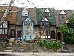
Upper Darby Township (often shortened to simply Upper Darby) is a home rule township bordering West Philadelphia in Delaware County, Pennsylvania, United States. Upper Darby is also home to the Tower Theater, a historic music venue on 69th Street built in the 1920s. Upper Darby's population is diverse, representing over 100 ethnic cultures. The township hosts a range of housing types including densely populated rowhouse sections, tree-lined neighborhoods of turn-of-the-century single-family houses and mid-century developments. It is Pennsylvania's sixth most populous municipality. Located just 2.8 miles from Center City (downtown Philadelphia), and houses the western terminus of the Market-Frankford Line of the SEPTA mass transit system of Philadelphia, with the location at 69th Street in the heart of Upper Darby's principal business district. Multiple trolley and bus lines connect the 69th Street Terminal to all major SEPTA lines of Delaware and Montgomery counties as well as Philadelphia.
Contents
- Map of Upper Darby PA USA
- Early settlement
- Division of Upper and Lower Darby
- 19th and 20th centuries
- Geography
- Emergency services
- Adjacent municipalities
- Demographics
- Historic sites
- Education
- Parochial schools
- Notable people
- References
Map of Upper Darby, PA, USA
Upper Darby is 65% residential, 25% commercial, and 8% other. As of the 2010 census, the township had a total population of 82,795. Because of a home-rule charter adopted in 1974 and effective in 1976, Upper Darby utilizes a mayor-council form of management, unlike communities that are still under the Pennsylvania Township Code. ("First Class" townships in Pennsylvania have a board of commissioners divided into wards, and "Second Class" townships having a board of supervisors, which are usually elected "at-large".)
Early settlement
In 1650, the area that eventually became Upper Darby had been inhabited by the Lenape tribe of Native Americans for hundreds of years, but war with the Susquehannock to the west along with devastating smallpox and measles epidemics had significantly reduced their numbers. The first permanent Europeans settlers arrived in late 1653 with a group from New Sweden. Soon after, in 1655, New Sweden was taken over by the Dutch, and then came under English rule in October 1664 as part England's overall conquest of New Amsterdam. The region was controlled as a possession of the English king until it was included in a large land grant to William Penn in 1681.
Upon Penn's founding of the colony of Pennsylvania the next year, the area was designated as part of the municipality of Darby Township, in Chester County. It was subsequently part of the eastern section of that county which was split off on September 26, 1789 to form Delaware County.
The Lower Swedish Cabin, thought to have been built in 1654, is located on Creek Road along the Darby Creek and is believed by many to be a remnant of the early Swedes, who introduced the log cabin to this area. Today the "Swedish Cabin" is designated with a Pennsylvania Historical Marker. The Cabin is also on the National Register of Historic Places.
Division of Upper and Lower Darby
Darby Township originally occupied the area between the current border of Upper Darby to the north, Cobbs Creek and then Darby Creek to the east and south, and Ridley and Springfield townships to the west. This continued until 1736, when, for the convenience of the inhabitants, it was decided at a town meeting to separate the upper part from the lower "in all matters save the levies made for the support of the poor," with the northern part thereafter to be called Upper Darby Township. The exact boundary was not established until 1787, when a petition was presented to the court. The following is an excerpt from this petition:
Beginning at Cobb's Greek on the Northwest side of a tract of land belonging to the heirs of Joshua Ash and in the line of said land, thence along said line and the line of land late Enoch Bonsall's & Joshua Bonsall's to Darby Creek thence down the said Creek to the northwest line of John Ash's land, thence along said line and the line of Samuel Ash and Nathaniel Smith to the line of Ridley Township, and that the lower part may be called Darby and the other part Upper Darby.
19th and 20th centuries
Reflecting the Quaker background of its earliest English settlers, Upper Darby was active in the antislavery movement. At least one abolition society existed prior to 1830, and sent a committee of twelve prominent citizens to the 1830 meeting of the Pennsylvania Anti-Slavery Society in Philadelphia.
Many homes in the area were stops on the Underground Railroad, including Hoodland, the home of abolitionist Thomas Pennock, which was eventually bequeathed to the township's public library and which currently houses the children's library, connected to a much larger modern annex which houses the Main Branch. Another prominent abolitionist, Thomas Garrett, grew up in the township and Thornfield, his home until the age of 32, still stands at Garrett Road and Maple Avenue in the Drexel Hill section of the township. Two regiments from Upper Darby took part in the fighting in the American Civil War, and one, the 106th, was involved in the Battle of Antietam.
The abundance of creeks and streams in the area favored the development of mills, and it was in Upper Darby that the first mills in Delaware County could be found. The mill trade greatly increased the population of the township, from just over 800 in 1800 to almost 5,000 by 1890. However, beginning in 1885, the township also lost large sections of territory as the citizens of more populated neighborhoods petitioned the state to be recognized as separate municipalities. The first of these was the borough of Clifton Heights (incorporated on June 1, 1885), followed by the boroughs of Lansdowne (July 6, 1893), Aldan (September 22, 1893), Millbourne (October 12, 1909), and East Lansdowne (June 3, 1911). (Part of the territory of Aldan was also taken from Darby Township.)
In 1907, the Philadelphia Rapid Transit Company recognized the potential for growth in the township and extended the Market-Frankford elevated train line (or "El") from just west of the Schuylkill River in Philadelphia to 69th and Market Streets in Upper Darby. The El terminus at 69th Street Station became a busy terminal serving several trolley and light rail lines into the suburbs, as well as numerous city and suburban bus routes. Commuter traffic spurred the development of the 69th St. shopping district in the 1920s by John McClatchy, and made Upper Darby the second busiest shopping area in the region, second only to Center City Philadelphia. The business district is noted for many fine examples of Art Deco style buildings. A population explosion in the township followed, and by the 1960s Upper Darby ranked as the 7th most populous municipality in Pennsylvania.
In the early 1970s, students from Highland Park Elementary School began a campaign to have the Pennsylvania Firefly declared the official state insect of Pennsylvania. With advice and support from state legislators, the students began a campaign that included letter writing, the circulation of petitions, and the distribution of bumper stickers. On April 10, 1974, Governor Milton J. Shapp signed their bill making the Pennsylvania Firefly their state's official insect. A couple of years later, Highland Park Elementary School was presented with a bronze plaque in honor of the students' achievement.
In 1991, five Upper Darby policemen were convicted in federal court and sentenced to prison for violating the civil rights of two residents, a father and son. Each was found guilty on several counts involving assault, false arrest, and prosecution.
Geography
According to the United States Census Bureau, the township has a total area of 7.9 square miles (20.4 km²). The township lies on the edge of the Piedmont slightly above the City of Philadelphia (60 to 260 feet above sea level). The area is crossed by several small creeks. The borough of East Lansdowne, Pennsylvania is an enclave completely surrounded by Upper Darby Township; additionally, an exclave of Upper Darby Township is separated from the rest of the township.
The census-designated place of Drexel Hill and the communities (or neighborhoods) of Aronimink, Beverly Hills, Bywood, Drexel Park, Highland Park, Llanerch Hills, Kellyville, Kirklyn, Oakview, Primos, Secane, Stonehurst, and Westbrook Park are part of Upper Darby Township.
Emergency services
Upper Darby Township is served by the 133-member Upper Darby Police Department, the Crozer-Keystone North Division Paramedics (based out of Delaware County Memorial Hospital), and the Upper Darby Township Fire Department, a combination paid/volunteer department which consists of a headquarters building and 5 stations: Company 20 - Garrettford-Drexel Hill (which is the only full-time volunteer station), housing 3 pumpers (engines), one ladder truck, and one rescue truck. Company 26 - Highland Park, housing 2 pumpers, one ladder truck, and one rescue truck. Company 36 - Cardington-Stonehurst, housing one pumper, one squrt, one ladder truck, and one air/light unit. Company 37 - Upper Darby, housing one pumper, one quint, and one utility truck. Company 74 - Primos-Secane-Westbrook Park, housing 2 pumpers (including a foam pumper) and one tower ladder truck.
Adjacent municipalities
Demographics
As of the 2010 census, the township was 56.6% White, 27.5% Black or African American, 0.2% Native American, 11.1% Asian, and 2.7% of the population were of two or more races. 4.5% of the population were of Hispanic or Latino ancestry.
As of the census of 2000, there were 85,038 people, 32,551 households, and 20,474 families residing in the township. The population density was 14,658.7 people per square mile. There were 34,322 housing units at an average density of 4,361.6 per square mile (1,683.8/km²). The racial makeup of Upper Darby was 59.1% White; 20.5% African American; 15.3% Asian; 0.12% Native American; 0.03% Pacific Islander; 0.52% from other races and 2.3% from two or more races. Hispanics or Latinos of any race were 2.4% of the population
There were 32,551 households, out of which 31.0% had children under the age of 18 living with them, 45.0% were married couples living together, 13.4% had a female householder with no husband present, and 37.1% were non-families. 31.6% of all households were made up of individuals, and 11.5% had someone living alone who was 65 years of age or older. The average household size was 2.50 and the average family size was 3.23.
In the township the population was spread out, with 25.2% under the age of 18, 8.4% from 18 to 24, 32.8% from 25 to 44, 19.9% from 45 to 64 and 13.7% who were 65 years of age or older. The median age was 35 years. For every 100 females there were 91.6 males. For every 100 females age 18 and over, there were 88.2 males.
The median income for a household in the township was $41,489, and median income for a family was $52,500. Males had a median income of $38,090 versus $30,416 for females. The per capita income for the township was $20,770. About 7.3% of families and 9.1% of the population were below the poverty line, including 11.1% of those under age 18 and 6.9% of those age 65 or over.
Upper Darby, along with Cheltenham and West Philadelphia are the areas in the Philadelphia region that have large Korean populations. The original Koreatown was in the Olney section of the city, and then moved to Logan section.
Historic sites
Education
Upper Darby Township's public education is provided by the Upper Darby School District. In all, the 12 public schools plus the Kindergarten Center serve nearly 12,000 students. The district has one high school, Upper Darby High School, and two middle schools, Beverly Hills Middle School and Drexel Hill Middle School. Upper Darby High School is the largest high school in Pennsylvania with almost 4,000 students.
In addition to the public school district, Upper Darby is home to several parochial and private schools. Monsignor Bonner High School (for boys) and Archbishop Prendergast High School (for girls), both Roman Catholic, are the largest private schools in the Township. Both schools offer grades 9–12 with a combined enrollment close to 5,500 students. In addition to the two high schools, there are nine parochial primary and middle schools located in the Township including the St. Lucy Day School for Children with Visual Impairments, with a combined enrollment of 2,867. Almost all of the private academic schools in the Township are administered by the Archdiocese of Philadelphia except for the Holy Child Academy, which is a Catholic academy run by the Society of the Holy Child Jesus.
Also available to residents of Upper Darby and surrounding areas is the Upper Darby Adult Evening Program (UDAEP). UDAEP offers professional development and general education classes to township residents. UDAEP is an independent non-profit entity separate from the Upper Darby School District.
Delaware County Community College operates a center in Upper Darby's Barclay Shopping Center.
Parochial schools
(The above schools merged in 2012 to become Monsignor Bonner and Archbishop Prendergast High School).