
Location Switzerland Range Jura Mountains | Elevation 691 m | |
 | ||
Similar Oberer Hauenstein Pass, Challhöchi Pass, Chilchzimmersattel, Salhöhe Pass, Benkerjoch Pass | ||
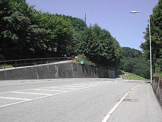
Unterer Hauenstein Pass (el. 691 m.) is a mountain pass in the Jura Mountains between the canton of Basel-Country and Solothurn in Switzerland.
Map of Unterer Hauenstein Pass, 4633 Hauenstein-Ifenthal, Switzerland
It connects Buckten in Basel-Country and Trimbach in Solothurn. The pass road has a maximum grade of 6 percent.
The pass was probably already used by the Romans. In 1993, Roman artifacts were discovered at the pass. It also lies close to the Roman settlement of Augusta Raurica.
References
Unterer Hauenstein Pass Wikipedia(Text) CC BY-SA