
Population 5,328 (2011 census) | Postcode(s) 4119 Postal code 4119 | |
 | ||
Location 19 km (12 mi) from Brisbane GPO | ||
Underwood is a suburb located south-east of the Brisbane central business district in Queensland, Australia. Its local government area is the Logan City Council.
Contents
Map of Underwood QLD 4119, Australia
The origin of the suburb name is from William Underwood who was an early property owner in the area.
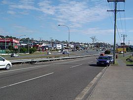
Logan Road, Kingston Road, Compton Road and surrounding area encompass the Underwood business centre which is a mixed-use urban development area incorporating the Underwood / Slacks Creek industrial estate as well as retail, commerce and office establishments.
The housing estates Arriva and Jacaranda are located in Underwood.
Demographics
In the 2011 census, Underwood recorded a population of 5,328 people, 49.9% female and 50.1% male. The median age of the Underwood population was 32 years, 5 years below the national median of 37. 59.6% of people living in Underwood were born in Australia. The other top responses for country of birth were New Zealand 6.3%, China 2.3%, England 2.2%, South Africa 1.9%, Korea, Republic of 1.8%. 67.7% of people spoke only English at home; the next most common languages were 4.5% Mandarin, 3% Cantonese, 2.2% Korean, 1.7% Arabic, 1.4% Hindi.