
Mountain type Maars Last eruption 1977 Parent range Aleutian Range | Elevation 91 m Mountain range Aleutian Range | |
 | ||
Location Becharof National Wildlife Refuge, Alaska, on Alaska Peninsula Similar Ugashik‑Peulik, Mount Chiginagak, Fourpeaked Mountain, Pavlof Sister, Mount Vsevidof | ||
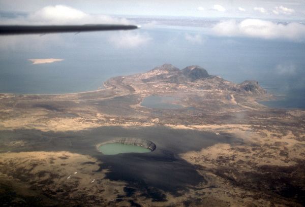
The Ukinrek Maars are two phreatomagmatic vents that formed on the north side of the Aleutian Range on a low area bordering the Bering Sea. The maars are 1.5 km south of Becharof Lake and 12 km northwest of Peulik Volcano. The western of the two is elliptical in shape and up to 170 m in diameter and 35 m deep. The east maar lies 600 m to the east and is circular and up to 300 m in diameter and 70 m deep. The east maar has a 49 m-high lava dome within the crater lake. The eruption occurred in March and April 1977 and lasted for ten days. There was no previous eruption. The magmatic material was olivine basalt from a mantle source. Pyroclastic surge from the eruptions traveled to the northwest. The volume of lava erupted was 9x10⁵ m3 and the volume of tephra expelled was 2.6x10⁷ m3.
Map of Ukinrek Maars, Alaska, USA
The Quaternary age Gas Rocks dacite domes some three km to the northeast were the site of a phreatic eruption some 2300 years ago.