
Time zone UTC-4 Elevation 804 m Local time Thursday 2:29 PM | Founded October 17, 1995 HDI (2000) 0.542 – medium Area 8,066 km² Population 9,309 (2014) | |
 | ||
Weather 26°C, Wind E at 21 km/h, 56% Humidity Points of interest Tepui, Punto triple, Monte Caburaí, Uei‑tepui, Wei‑Assipu‑tepui | ||
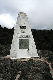
Uiramutã is a municipality located in the northeast of the state of Roraima in Brazil. Its population is 9,309 (as of 2014) and its area is 8,066 km². It is the northernmost city in Brazil, with Monte Caburaí being the northernmost point. West of this mountain, there is also the Monte Roraima, the tallest mountain in Roraima and in Guyana, located in the triple frontier of Brazil, Guyana and Venezuela. Still, Uiramutã holds the title of the northernmost urban seat of a municipality in Brazil. Its counterparts in the South, West and East are respectively Chuí, state of Rio Grande do Sul; Mâncio Lima, Acre; and João Pessoa, Paraíba.
Map of Uiramut%C3%A3 - State of Roraima, Brazil
The municipality is located entirely inside the Raposa Serra do Sol Indian Reservation. Because of this, its economic activities are limited. As a result, Uiramutã is also noted for being the Brazilian municipality that depends the most on government funds: 80% of its income is provided by the public administration, including social insurance and welfare programs such as the Bolsa Família.
The municipality contains the 116,748 hectares (288,490 acres) Monte Roraima National Park, a protected area created in 1989.