
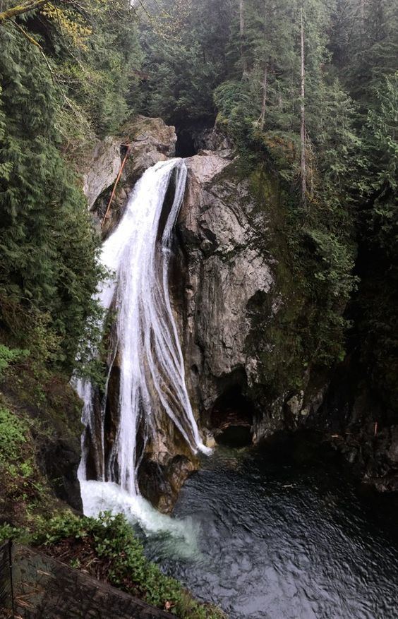
Type Fan Average width 30ft Elevation 265 m Watercourse Snoqualmie River | Total height 135ft Height 41 m Number of drops 1 | |
 | ||
Location southeast of North Bend, Washington Similar Olallie State Park, Cascade Range, Twin Falls Natural Area, Upper Twin Falls, Franklin Falls | ||
Twin Falls is a waterfall on the South fork of the Snoqualmie River, off exit 34 on I-90 in the Olallie State Park. Twin Falls features a well-hidden underground run-of-the-river hydroelectric project that generates 24 MW of electricity. The powerhouse is located 325 feet below ground.
Map of Twin Falls, Washington, USA
References
Twin Falls (Washington) Wikipedia(Text) CC BY-SA