
Built 1867 (1867) Opened 1867 Added to NRHP 2 May 1982 | NRHP Reference # 82004966 Area 53 ha | |
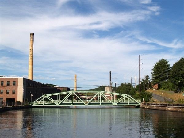 | ||
Location Roughly bounded by Connectict River, Power Canal, 9th and L St., Turners Falls, Massachusetts Architect William P. Crocker; C.W. Hazelton | ||
Turners Falls Historic District is a historic district encompassing much of the historic center of the village of Turners Falls in the town of Montague, Massachusetts. It is roughly bounded by the Connecticut River, Power Canal, 9th and L Street. The district was listed on the National Register of Historic Places in 1982.
History
The village of Turners Falls was founded in 1868 as a planned industrial community, designed to capitalize on the water power of the Connecticut River. Alvah Crocker, a businessman from Fitchburg sought to harness the river's power by damming the river and directing water into a power canal, where it might be sold to businesses located on its banks. Adjacent to the power canal, Crocker laid out a grid of streets (numbered in one orientation, lettered in the other), with Avenue A as its principal thoroughfare.