
Airport type Public 12/30 2,985 Elevation 48 m | Operator City of Turlock Elevation AMSL 159 ft / 48.5 m 2,985 910 | |
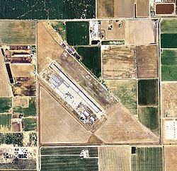 | ||
Turlock Municipal Airport (FAA LID: O15) is a public airport located eight miles (13 km) east of Turlock, serving Stanislaus County, California, USA. This general aviation airport covers 320 acres (129 ha) and has one runway.
World War II
During World War II, the airport was designated as Ballico Air Force Auxiliary Field, and was an auxiliary training airfield for Merced Army Airfield, California.
References
Turlock Municipal Airport Wikipedia(Text) CC BY-SA