
Country Japan District Agatsuma - Flower Japanese Gentian Population 9,691 (Feb 2015) Prefecture Gunma Prefecture | Region Kantō - Tree Silver birch Area 337.6 km² Local time Sunday 11:40 AM | |
 | ||
Time zone Japan Standard Time (UTC+9) Weather -1°C, Wind E at 3 km/h, 77% Humidity Points of interest Mount Kusatsu‑Shirane, Mount Azumaya, Asama Volcano Museum, Manza Hot Spring, Karuizawa Toy Kingdom | ||
Tsumagoi (嬬恋村, Tsumagoi-mura) is a village located in Agatsuma District of west-central Gunma Prefecture in the northern Kantō region of Japan. As of February 2015, the village had an estimated population of 9,691 and a population density of 28.7 persons per km². Its total area was 337.51 km².
Contents
- Map of Tsumagoi Agatsuma District Gunma Prefecture Japan
- Geography
- Surrounding municipalities
- Climate
- History
- Economy
- Senior high schools
- Junior high schools
- Elementary schools
- Train
- Highway
- Local attractions
- Noted people from Tsumagoi
- References
Map of Tsumagoi, Agatsuma District, Gunma Prefecture, Japan
Geography
Tsumagoi is situated on the northwestern corner of Gunma Prefecture, touching Nagano Prefecture to the north, south, and west. Because of its elevated location and the ash deposits of Mount Asama, Tsumagoi is fit and well known for growing cabbages. It has a cool climate, with an average yearly temperature of 7℃.
Surrounding municipalities
Climate
Tsumagoi has a humid continental climate (Köppen Dfb), due to the high elevation. Winters are cold, with a January 24-hour average temperature of −4.6 °C (23.7 °F), while summers are warm and wet, with a July 24-hour average temperature of 19.5 °C (67.1 °F).
History
Numerous Jomon period remains have been found in Tsumagoi, although later Yayoi period artifacts are almost non-existent, as the area is not suitable for rice cultivation. During the Edo period, the area around Tsumagoi was part of the hatamoto-administered territory within Kōzuke Province. With the creation of the municipalities system after the Meiji Restoration on April 1, 1889, the village of Tsumagoi was created within Agatsuma District of Gunma Prefecture.
Economy
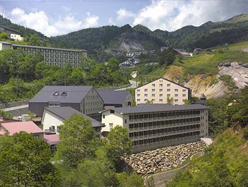
The economy of Tsumagoi is primarily agricultural, with cabbages forming the most noted local crop. Seasonal tourism primarily in connection with its onsen hot spring resorts and ski resorts are also major contributors to the local economy.
Senior high schools
Junior high schools
Elementary schools
Train
Highway
Local attractions
The main draw of tourists to Tsumagoi are the onsen (natural hot spring) resorts, some of which are also associated with ski resorts. There are two major hot spring resort areas within the town.