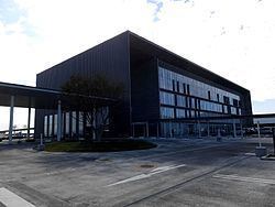
Area 110.9 km² Local time Sunday 10:53 AM | Phone number 0256-92-1111 Population 79,548 (Jun 2016) | |
 | ||
Website www.city.tsubame.niigata.jp Weather 8°C, Wind N at 14 km/h, 61% Humidity Points of interest Kokujō‑ji Temple, Tsubameshikotsu Park, Shinanogawaokozu Center, Kugamiyama, Anryo Temple | ||
Tsubame (燕市, Tsubame-shi) is a city located in north-central Niigata Prefecture, in the Hokuriku region of Japan. As of 1 June 2016, the city had an estimated population of 79,458 and a population density of 716 persons per km². Its total area was 110.96 square kilometres (42.84 sq mi).
Contents
- Map of Tsubame Niigata Prefecture Japan
- Geography
- Surrounding municipalities
- History
- Education
- Railway
- Highway
- Places
- Events
- Sister cities
- Noted People from Tsubame
- References
Map of Tsubame, Niigata Prefecture, Japan
Geography
Tsubame is located in the coastal plains of central Niigata Prefecture, but does not have a coastline on the Sea of Japan.
Surrounding municipalities
History
The area of present-day Tsubame was part of ancient Echigo Province. The town of Tsubame was established on April 1, 1889 with the creation of the municipalities system. It was raised to city status on March 31, 1954 by merging with the neighbouring villages of Koike, Konakagawa and Matsunaga. On March 20, 2006 Tsubame absorbed the towns of Bunsui and Yoshida (both from Nishikanbara District).
Education
Tsubame has 15 public elementary schools and five public middle schools. There are three public high schools operated by the Niigata Prefectural Board of Education, and also one special education school.
Railway
Note: Although the nearest stop on the Jōetsu Shinkansen is called Tsubame-Sanjō Station, the station is physically located in the city of Sanjō and not in Tsubame.
