
Country United States GNIS feature ID 453902 Local time Saturday 11:46 AM | FIPS code 18-76616 Elevation 198 m Population 3,711 (2010) | |
 | ||
Weather 20°C, Wind S at 27 km/h, 61% Humidity Area 115.1 km² (113.6 km² Land / 150 ha Water) | ||
Troy Township is one of eleven townships in Fountain County, Indiana. As of the 2010 census, its population was 3,711 and it contained 1,657 housing units.
Contents
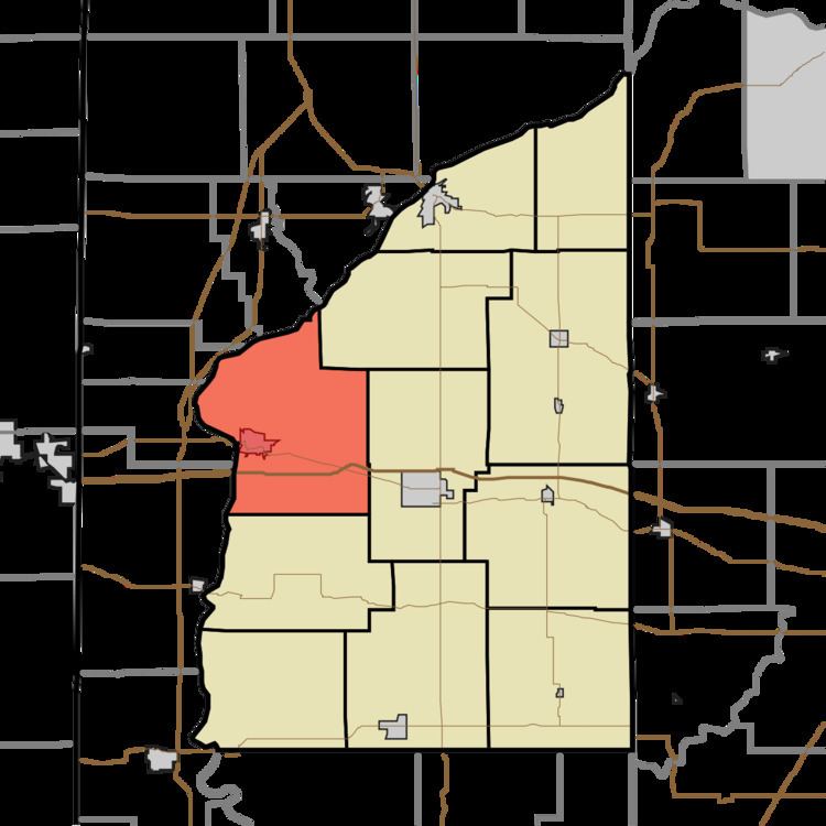
Map of Troy Township, IN, USA
Geography
Troy Township lies along the western side of Fountain County; the Wabash River defines the western borders of both. According to the 2010 census, the township has a total area of 44.44 square miles (115.1 km2), of which 43.86 square miles (113.6 km2) (or 98.69%) is land and 0.58 square miles (1.5 km2) (or 1.31%) is water.
Troy Township contains the Fountain County seat of Covington, in the western part of the county near the river. At one time, the unincorporated community of Layton existed in the southeast part of the township along the present route of U.S. Route 136.
Interstate 74 passes through the southern part of the township. U.S. Route 136 lies to the north of I-74 for most of its route; it passes through Covington, but east of Layton, I-74 crosses to its north side.
Cemeteries
The township contains the four cemeteries of Bend, Mount Hope, Prescott Grove and Sand Hill.