
Population 952 (2011 Census) Sovereign state United Kingdom Local time Saturday 2:00 PM | OS grid reference TL898721 Postcode district IP32 | |
 | ||
Weather 14°C, Wind NE at 23 km/h, 28% Humidity | ||
Troston is a village in the English county of Suffolk.
Map of Troston, Bury Saint Edmunds, UK
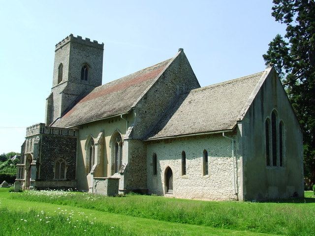
It is around five miles north-north-east of Bury St Edmunds. Its parish church contains rare mediaeval wall paintings, including dragon-slaying and the Martyrdom of St Edmund. It had one public house called The Bull. The village shop, formerly a Wesleyan chapel, has been closed for some time, and is now a private residence. The centre of the village, surrounded by farms, is characterised by housing estates built through the 1950s to 1970s, with minor, more localised, expansion since. Local children attend primary school in nearby Honington.
The local pub, The Bull, has been a central part of the village since the late 1800s, but has now closed, leaving it boarded up. Owners, brewers Greene King, intend to sell it as a pub, and have controversially dug up the local playing and football field, intending to develop it into a housing estate.
Troston Hall, to the south of the village is a listed late sixteenth-century manor house, accompanied by the listed Hall Farm to its immediate north.
In total, there are an impressive 17 listed buildings in the village.