
Elevation 2,366 m | Mountain range Prokletije | |
 | ||
Similar Đeravica, Guri i Kuq, Dobra Kolata, Maja e Hekurave, Žljeb | ||
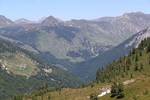
Tromedja (Albanian: Trekufiri; Montenegrin and Serbian Cyrillic: Тромеђа, Tromeđa) is a mountain in the Bogićevica area in the Prokletije range. Its peak which measures a height of 2,366 m (7,762 ft) above sea level forms a boundary between Albania, Kosovo and Montenegro. Albania contains the south of the mountain which is the majority of it, Kosovo the north-east and Montenegro the north-west. There is a valley in the Albanian and Kosovan side of the mountain. The village of Debërdol in Albania is located quite close to the summit.
Map of Tromedja, Albania
References
Tromedja (mountain) Wikipedia(Text) CC BY-SA