Area code(s) +387 33 Area 337 km² | Time zone CET (UTC+1) | |
 | ||
Weather 7°C, Wind W at 2 km/h, 75% Humidity | ||
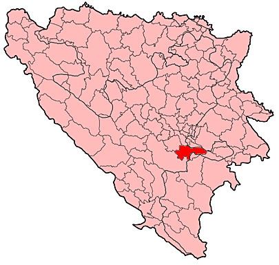
Trnovo is one of the nine municipalities of the Sarajevo Canton. It is located a 30 kilometers southeast of the city of Sarajevo. The seat of the municipality is in Trnovo, although the municipal council uses the "Maršal" Hotel on Mount Bjelašnica as the official meeting hall. As a result of the 1995 Dayton Accords, the municipality was divided between the Federation of Bosnia and Herzegovina (FBiH) and Republika Srpska (RS).
Contents
VillagesEdit
• Balbašići • Bobovica • Brda • Brutusi • Čeružići • Češina Strana • Čunčići • Dejčići • Delijaš · Deseci • Dujmovići • Durakovići • Gornja Presjenica • Hamzići • Jelačići • Karovići • Kramari • Krsmanići • Ledići • Lisovići • Lukavac • Mađari • Mijanovići • Obla Brda • Ostojići • Pendičići • Pomenovići • Prečani • Rakitnica • Rijeka • Sjeverovići • Šabanci • Šabići • Šišići • Trebečaj • Trnovo • Tušila • Umčani • Umoljani • Zagor
DemographicsEdit
The pre-war municipality, with 63 settlements, had a total population of 6,991 people, of whom Muslims (or Bosniaks) were 68.81% and Serbs 29.45%. The Muslim-inhabited settlements became part of the Trnovo municipality of Federation B&H. According to data from the municipality, it is the least populous municipality in the Sarajevo Canton, with a population of 1,747. It is also the least densely populated of the nine municipalities, and has the highest percentage of people over 65 years of age.
Ethnically, 95.4% are Bosniaks and 4.6% are Serbs and this accounts for the entire population.
TourismEdit
The mountain of Bjelašnica is located within the municipality, offering possibilities for tourism development. However, until there is sufficient infrastructure for tourism development, agriculture remains the main branch of the economy. The stunning Rakitnica canyon is also located within Trnovo municipality.
