
 | ||
Transportation in Tulsa, Oklahoma is aided by a bus network and a system of raised highways and primary thoroughfares laid out in mile-by-mile increments. In addition, through its entire duration through Tulsa, historic Route 66 is a drivable road with motels and restaurants reminiscent of the route's heyday era. Tulsa Transit is the city's primary public transit system, operating by bus. The system has two operating transit centers. One is located on Denver Avenue and the other is located east of Memorial on 33rd Street.
Contents
History
Tulsa streets were simply dirt tracks until after the turn of the 20th century. The first contract for paving was awarded in 1906. Bricklaying did not begin until October of that year and proceeded slowly because local demand for bricks far exceeded the capacity of nearby brick plants. Later, streets were paved with concrete or asphalt.
Streetcars
The Tulsa Street Railway Company (TSR) was formed in 1905 by a group of 18 private investors, led by real estate developer Grant Stebbins. By the end of 1906, TSR had electric streetcars operating downtown along Main, Third and Fifth Streets. One reference states that the street car lines were completed even before the streets were paved. In 1909, the Oklahoma Union Traction Company (OUT) built another streetcar line that ran from Owen Park to 18th Street and Lewis, an area now known as Swan Lake. The route went through downtown on Fourth Street, south on Elgin to 11th Street, and then turned south on Lewis. TSR then built a line from First and Peoria to Kendall College. By 1923, TSR owned 21 miles (34 km) of track and 52 trolley cars. Several more lines were built until the 1920s, when private cars and taxis became more abundant and ridership began to decline. TSR was sold in 1926 to United Service Company. The street car system was sold again in 1936 to National City Lines. OUT went bankrupt in 1935. The trolley wires and rails were removed, and public transportation turned exclusively to buses.
Tourist Shuttle
Starting Nov 2, 2012 the city of Tulsa introduced a newly revived Tulsa Trolley system, that would run every Friday & Saturday from 5pm through 2am to three of some of the City's most popular entertainment areas: the Blue Dome, Brady Arts, and Deco Districts, free of charge.
Interurbans
In 1911, the Sand Springs Railway Company built an interurban line connecting Tulsa and Sand Springs. The Tulsa Sapulpa Union Line (originally named Sapulpa and Interurban Railway) connected those two towns with the oilfields. All of these lines are defunct. The Sand Springs line was the last interurban operating in Oklahoma, and ceased operating January 2, 1955. The Tulsa Sapulpa line went bankrupt in 1917 and again in 1934, when it acquired its present name. It still operates as a freight-hauling Class III short-line railroad with 23 miles of track connecting BNSF in Sapulpa with Union Pacific in Tulsa.
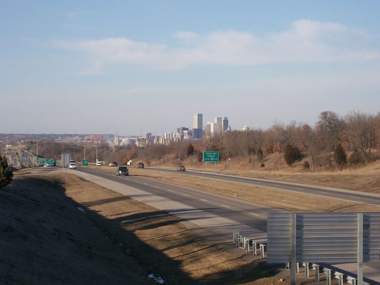
Highways
Interstate 44 and the Skelly Drive Bypass crosses Tulsa through midtown from east and west, while its sister highways, Interstate 244 and Interstate 444, make up the inner-dispersal loop surrounding downtown and wrap through the northern part of the city, reconnecting to Interstate 44 in the east and southwest parts of the city. U.S. Highway 412 leaves the city from its most eastern and western points, but through most of its duration in Tulsa it is primarily concurrent with Interstate 244. U.S. Highway 64 forms the Broken Arrow Expressway to the east, going as far as the Sand Springs Expressway to the west. U.S. Highway 75 traverses West Tulsa through downtown going north and south, while U.S. Highway 169, also called the Mingo Valley Expressway or the Pearl Harbor Memorial Expressway, generally traverses the city in its eastern areas in a north–south direction. State Highway 11 serves the Tulsa International Airport, connecting from I-244 and Highway 75. The Creek Turnpike splits away from Highway 169 from the South and Interstate 44 from the East, bypassing most of the city of Tulsa and the suburb of Broken Arrow, eventually reconnecting with I-44 in Catoosa to the east and Jenks to the west.
Tulsa Interstate 44 was faced with a sinkhole found on the right lane of the westbound traffic between Lewis and Peoria on June 2, 2010. According to the local channel 6 news, the sinkhole measured 12 feet wide and 24 feet long. Fortunately traffic was only affected for a short period of time and has since been reopened.
Street network
Tulsa follows a systematic naming and numbering convention for all streets falling within its municipal jurisdiction. Admiral Place is the east–west-running dividing line for "streets north" and "streets south", while Main Street is the north–south-running dividing line for "west avenues" and "east avenues." Avenues falling west of Main Street are named for US cities west of the Mississippi River for one run of the alphabet, after which numbered "west avenues" are assigned. Avenues falling east of Main Street are named for US cities east of the Mississippi River for approximately three runs of the alphabet, after which numbered "east avenues" are assigned. Streets falling north of Admiral Place are labeled for important names in Tulsa's history for one run of the alphabet, after which numbered "streets north" are assigned. Streets falling south of Admiral Place are numbered, beginning with "1st Street" and continuing southward. Street names and numbers are consistent throughout the Tulsa jurisdiction, regardless if a particular street is contiguous or continuous.
Addresses reflect their associated hundred block from either Admiral or Main. There are usually 16 blocks per mile as counted by avenues, and there are 10 blocks per mile as counted by streets. Other right-of-way labels (such as Place, Court, Drive, Terrace, etc.) may be used to describe an intermittent street or avenue, but the actual name will usually be the same as the adjacent street or avenue (such as Knoxville Avenue and its neighboring Knoxville Place, both assigned as the 3600 block east). Major arterial streets can be found at every mile, as assigned by the township-and-range system, resulting in a well-defined grid of thoroughfares across the Tulsa region. As an example, east–west-running thoroughfares south of Admiral Place are streets ending with a 1, including 11th Street, 21st Street, 31st Street, etc.