
Time zone PST (UTC−8) GNIS feature ID 1511568 Zip code 98649 Area code 360 | FIPS code 53-72100 Elevation 152 m Local time Monday 2:34 PM | |
 | ||
Weather 13°C, Wind NW at 8 km/h, 45% Humidity | ||
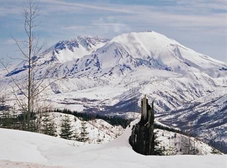
Toutle is an unincorporated community in Cowlitz County, Washington. Toutle is located 10 miles (16 km) east of Castle Rock along Washington State Route 504, which is also known as the Spirit Lake Memorial Highway. The Toutle community, similar to Toutle River, takes its name from the Hullooetell, a band of the Skillot - a Chinookan tribe. The Toutle community is part of the Toutle Lake School District, a K-12 school district of about 600 students. Toutle is near Mount St. Helens and the Mount St. Helens National Volcanic Monument, which lies at the end of the Spirit Lake Memorial Highway. The eruption of Mount St. Helens on May 18, 1980 was the deadliest and most economically destructive volcanic event in the history of the United States.
Contents
Map of Toutle, WA, USA
Geography
Toutle is located at 46°19′29″N 122°44′11″W (46.3248338, -122.7365001).