
 | ||
Tlacotepec de Mejía is a municipality located in the montane central zone in the State of Veracruz, about 40 km from state capital Xalapa. It has a surface of 90.48 km2. It is located at 19°12′N 96°50′W. The name comes from the language Náhuatl, Tlaco-tepec; that means “In the hill of the sticks of wood".
Contents
Map of Tlacotepec de Mej%C3%ADa, Ver., Mexico
Geographic Limits
The municipality of Tlacotepec de Mejía is delimited to the north by Totutla, to the east by Puente Nacional and to the south by Comapa. It is watered by the rivers Atliyac and Paso de Ovejas that are tributaries of the river La Antigua
Agriculture
It produces principally maize, coffee and sugarcane.
Celebrations
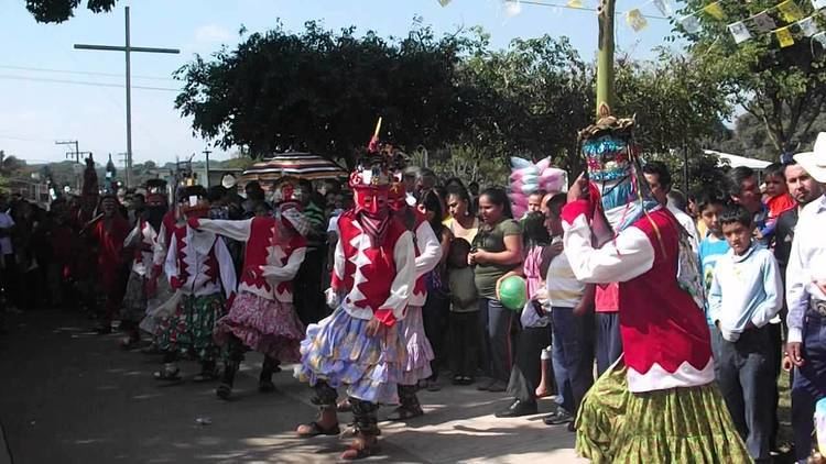
In Tlacotepec de Mejía , in November takes place the celebration in honor to San Martín Caballero, Patron of the town, and in December takes place the celebration in honor to Virgen de Guadalupe.
Weather
The weather in Tlacotepec de Mejía is cold and wet all year with rains in summer and autumn.