
 | ||
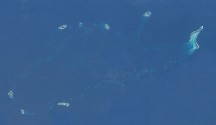
The Tizard Bank, in Chinese known as 郑和群礁 or Zhenghe Qunjiao, 10°15′N 114°30′E is a partially sunken atoll and one of the significant maritime features in the Spratly Islands in the northern part of the Group.
It was named after Thomas Henry Tizard (1839 – 17 February 1924) a British oceanographer and surveyor who surveyed the Bank aboard HMS Rifleman in the 1860s. in 1947 the Republic of China government gave the Bank the name Zheng He Archipelago after the famous Ming-era admiral, although there is no evidence that he ever visited Tizard Bank.
From before the 1870's the islands were used by fishermen from Hainan with Itu-aba Island having a semi-permanent settlement of Chinese fishermen.
The Bank raises steeply from surrounding depths ranging from 500 to 700 meters. It is 32.05 nautical miles (59.36 km; 36.88 mi) in length, and extends from the Gaven Reefs to the NW of Dangerous Ground. The Atoll is up to 11.36 nautical miles (21.04 km; 13.07 mi) wide. The total area is 953 km², and the greatest depth of the central lagoon is 80 meters. The central lagoon generally is 10 to 40 meters deep, although many coral heads have much shallower depths. There are several entrances into the lagoon.
The bank contains a number of features along the rim of the reef, including shoals, reefs, islands, and cays, numerous wrecks, some lighthouses, and an ammunition dumping ground. Several coral heads with depths of 6-12m lie in the lagoon, and depths "3.7m less than charted can be expected. ... Mariners should navigate with extreme caution in this vicinity."
Features in the area include:
It is neighboured by the Loaita Bank to the North, Discovery Great Reef to the west, and the Union Banks to the south.