
Country India State Tamil Nadu | Language spoken Tamil District Tiruppattur | |
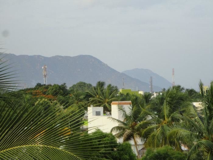 | ||
Map of Tiruppattur, Vellore
Tirupattur is a town in Vellore District, India, one of the oldest towns in Tamil Nadu. It is approximately 40 km from Krishnagiri, 85 km from Hosur, 85 km from Thiruvannamalai and 125 km from Bangalore. The town has mainly small-scale industries and mills, and has been an important commercial center from time immemorial.
Contents
- Map of Tiruppattur Vellore
- Overview
- History
- Tourism
- Location and overview
- Climate
- Geography
- Demographics
- Main sights
- Transport
- Politics and municipal administration
- References
Overview
The name Tirupattur means a group of ten villages/small towns. There exists a village called Aathiyur (Aathi means Begin) in the southern fringes of the Town and Kodiyur (Kodi means End) in the northern fringes of the town. It is surrounded by several of these villages, making Tirupattur a Taluk.It has Old Shiva, Vishnu temples and Tanks (Big Tank & Small Tank) built during the Hoysala Dynasty. It is well connected by road and rail to other important cities of Tamil Nadu such as Thiruvannamalai, Chennai, Salem, Coimbatore and Vellore and to Bangalore in Karnataka. This town is also famous in Islamic religious circles as many great saints "Awliyas" had made it their home town. Some of them are buried at various places in the town, including Syed Sha Mohammed alias Syed Khawja Meeran Hussaini Jaffari, Syed Sha ameenuddin Hussaini Chisty ur Kahdri (who is better known as Munshi); he was the last among a series of saints who have lived and have been buried at Tirupattur. As of 2011, the town had a population of 64,125.
Tirupattur has been a Revenue Sub Division since the British Raj, earlier as a part of Salem District and then as a part of Vellore District. Tirupattur, Natrampalli, Vaniyambadi and Ambur taluks form the Tirupattur Sub Division. India's first lady IAS officer Anna Rajam Malhotra, independent India's first foreign Secretary KPS Menon, present Secretary to the PM Modi Dr.T.V Somanathan were all Sub Collectors of Tirupattur.
Tirupattur Municipality was constituted as a third grade municipality in the year 1886. As per G.O. No. 194, date: 10.02.1970, classified as Second Grade Municipality. At present from 1.4.1977 onward as per G.O. No. 654, classified as first grade municipality.
Tirupattur's population and land area are good enough to have political representations in the state legislature of Tamil Nadu (Member of the Legislative Assembly), and part of Thiruvannamalai constituency for the central/federal legislature of India (Member of Parliament as of 2009 elections). municipality link - http://municipality.tn.gov.in/thirupathur/
History
Tirupattur is called as the "Sandal City", Even a rough estimation cannot easily be established on the origin of Tirupattur town, owing to its antiquity.
From the inscriptions so far surveyed by Archaeological Survey of India in Tirupattur, it is estimated that this town is more than 1600 years old. During the regimes of various rulers like Cholas, VijayaNagara Dynasty, Hoysalas the town had been referred to, by the following names: Sri Mathava Chaturvedi Mangalam,Veera Narayana Chaturvedi Mangalam, Tiruperur and Brahmapuram (Brahmeeswaram). The present name "Tirupattur" might have got derived from "Tiruperur". Erstwhile "Tiruperur" or "Sri Madhava Chaturvedi Mangalam" was in "Eyyil Nadu", subdivision of "Nigarili Chola Mandalam", division of "Chola Empire". There existed a fort in the eastern part of the town around 800 years ago. Its entrance might have been near the Kottai Darwaja Sri Veera Anjaneyar Temple, since the word "Kottai" in Tamil means "Fort", and the word "Darwaja" in Hindi/Urdu means "Gate" or "Door". The area is still known as "Kottai"(fort). This city is a home for many Sufi saints, the last known Sufi was Muhayeedeen Hussaini, famously known as "Ghouse peeran saheb".
Tourism
Yelagiri or Elagiri is a small hill station between the towns of Vaniyambadi and Jolarpettai (Tamil Nadu, India), dating back to British colonial days.
"The Whole of Yelagiri was once the private property of the Yelagiri Zamindar Family. It was taken over by the government of India during the Early 1950s. The house of the Yelagiri Zamindars still exists in Reddiyur."
Fr. Francis Guezou of Don Bosco, worked for the uplift of hill tribals. He has been the main reason for the educational upliftment to the people of Yelagiri.
At a distance 37 km from Yelagiri, 37 from Athanavur and 13 km from Thirupattur, magnificent Jalagamparai Waterfalls near Jadayanur is created by the River Attaaru running through the valleys of Yelagiri Hills. It is one of the best places to visit in Yelagiri Hills.
Jalagamparai waterfalls is flowing down from a height of 15 meters, the place is popular among lovebirds. Bathing in this waterfall cures diseases because it passes through various herbal plants in the hills. The falls has a trek route and also a motorable road. The falls can be reached after 1.5 hour trek of 6 km from Nilavoor (6 km from Yelagiri Punganoor Lake). It is little tough trek, but the view of the valley from the falls is truly amazing. Local guides are available to guide the trek to the falls.
The motorable road passes through Thirupattur (13.4 km away) which needs 5-10 minutes walk. The isolated location of the waterfalls attracts people in large groups for picnicking. The flow of water in the Jalagamparai Waterfalls has considerably been reduced as compared to recent past years but its charm and picturesque beauty is still intact. Adjacent to the Jalagamparai falls, there is a Murugan temple within a building constructed in the shape of a Lingam.
Jalagamparai Waterfalls is at its best from November to February when it is gushing with water but the waterfall is dry in summer.
Location and overview
The Yelagiri hill station is not as developed as other hill stations in Tamil Nadu such as Ooty or Kodaikanal. However, the district administration has now taken up the task of developing Yelagiri Hills into a tourist destination by promoting adventure sports such as paragliding and rock climbing. The road to Yelagiri is well constructed and punctuated with the milestones and signboards. Petrol pumps are sufficient, making travel convenient and easy.
Yelagiri is one of the famous places for trekkers in India. The hill station is located at a height of 1410.6 meters above sea level. Yelagiri comprises 14 hamlets and a number of temples spread over several hills.
The highest point in Yelagiri is the Swamimalai Hill, standing tall at 4,338 ft; Swamimalai is a popular destination for trekkers. The view from the summit is spectacular. The hill provides a good number of trekking trails through thick reserved forests. Mangalam, a small village, is at the base of this hill. There are other trekking options that include smaller peaks such as the Javadi and Palamathi Hills.
Yelagiri Hills is home to hundreds of snakes.
Climate
Yelagiri's climate is classified as tropical. In winter, there is much less rainfall than in summer. This climate is considered to be Aw according to the Köppen-Geiger climate classification.
Geography
It is known as the "Sandalwood Town" due to the abundant availability of sandalwood trees in the surrounding hills.It is very close to the 4th major hill station of Tamil Nadu, the Yelagiri hills, which is also known as the common man's Ooty. The town is at an average elevation of 388m. The Javadhu Hills,a part of the eastern ghats lie another to the east of Tirupattur .
Tirupattur town has 56.059 km length of roads and the municipality is maintaining ‘B’ Grade Bus stand in the heart of the town. There is a century old municipal market having 413 shops which helps in promoting commercial and economic activities of the town. This town is known for recording coldest temperature in the Tamil Nadu plains during winter. The seasonal climate conditions are moderate and the weather is uniformly salubrious. The town experiences hot summers and cool winters. The town gets its majority of rainfall during the south west monsoon period. September and October are the wettest months with around 400 mm of rain being received in these two months. The town also experiences fairly frequent thunderstorms in late April and May, which gives necessary relief from the heat, along with the dip in night temperatures. The warmest nights are in May, when the town has an average minimum temperature of 23.4 °C. The coldest nights are in January, when the average minimum temperatures drop to 16.1 °C. May is the hottest month with an average maximum of 37.0 °C. The highest ever temperature recorded in the town is 46.3 °C on 7 May 1976. The lowest ever recorded temperature is 10.2 °C on 15 December 1974. The highest 24‑hour precipitation is 167.3 mm received on 4 November 1966. The average annual rainfall being received in the town is 982 mm. The major group of soils that are found in the town are black and red varieties. The red soil constitutes 90 percent while black soil only 10 percent.
Demographics
According to 2011 census, Tirupattur had a population of 19,487 with a sex-ratio of 1,010 females for every 1,000 males, much above the national average of 929. A total of 7,255 were under the age of six, constituting 3,717 males and 3,538 females. Scheduled Castes and Scheduled Tribes accounted for 18.33% and .43% of the population respectively. The average literacy of the town was 76.22%, compared to the national average of 72.99%. The town had a total of 14084 households. There were a total of 22,895 workers, comprising 240 cultivators, 161 main agricultural labourers, 1,145 in house hold industries, 18,782 other workers, 2,567 marginal workers, 38 marginal cultivators, 27 marginal agricultural labourers, 246 marginal workers in household industries and 2,256 other marginal workers. As per the religious census of 2011, Tirupattur (M) had 71.93% Hindus, 26.39% Muslims, 1.52% Christians, 0.03% Sikhs, 0.02% Buddhists, 0.11% Jains, 0.00% following other religions and 0.01% following no religion or did not indicate any religious preference.
Main sights
Yelagiri is a hill station on the Vaniyambadi-Tirupattur Road, midway between Chennai and Bangalore. Located at an altitude of 1,050 metres (3,500 ft) and spread across 30 km2, the Yelagiri village (also spelt Elagiri at times) is surrounded by orchards, rose-gardens, and green valleys. Vainu Bappu Observatory, Sri vetkaaliamman temple(142 feet height)(13 km) kandhili, Bheeman Falls(38 km from Tirupattur)Jalagamparai Falls (14 km from Tirupattur) are other prominent tourist destinations around the town. Jalagamparai waterfalls is found on the eastern slope of the Yelagiri hills. The Javadi Hills are located about 35 km from Tirupattur. In the middle of this hill, lies the Kavalur Observatory, which has several optical and reflective telescopes run and governed by the Indian Institute of Astrophysics.
Transport
The Tamil Nadu state Bus transport corporation (TNSTC) is providing 85% of transport facilities to this town. Tirupattur is well connected by road and rail to major cities of India. Regarding transportation linkage, the highway (NH 46) from Chennai to Krishnagiri (via) Natrampalli passes through the outskirts of the town. The town is separated by a distance with Chennai (225 km), Bangalore (130 km), Vellore (87 km) and Salem (108 km). Several State Highways connects the town from Dharmapuri (60 km), Krishnagiri (40 km) Vaniyambadi (22 km), Harur (47 km) and Salem (108 km) section. TNSTC also operates luxury Volvo A/C buses (Route no: 502 B) to Chennai daily. Frequent buses are there to Chennai, Vellore, Harur, Salem, Bangalore, and Villupuram.
Tirupattur Railway Station is under the administrative control of the Southern Railways. It is 2 km from the bus stand. Traveling north, Jolarpettai Junction (8 km) is the nearest junction, and going south-west, Morappur is the next station. Due to proximity to the Jolarpettai Railway Junction only few express trains halt here.
The nearest airports are at Salem (105 km) and Vellore Air Strip (85 km), while the nearest international airports are at Bengaluru (135 km) and Chennai (225 km).
Politics and municipal administration
The Tirupattur assembly constituency is part of Tiruvannamalai (Lok Sabha constituency).mr G.shanmugam The present MP of the Tiruvannamalai Lok Sabha Constituency is Mrs. Vanaroja B.A,B.L, MSC.