
Population 175 (2006 census) LGA(s) South Burnett Region Tingoora Charlestown Local time Sunday 12:34 AM | Postcode(s) 4608 State electorate(s) Callide Postal code 4608 Federal division Division of Flynn | |
 | ||
Location 249 km (155 mi) NE of Brisbane
23 km (14 mi) N of Kingaroy
8 km (5 mi) SW of Wondai Weather 19°C, Wind SE at 13 km/h, 74% Humidity | ||
Tingoora is a town in the South Burnett region of Queensland, Australia. The town is in the South Burnett Region LGA and on the Bunya Highway, 249 kilometres (155 mi) north west of the state capital, Brisbane. At the 2006 census, Tingoora had a population of 175.
Map of Tingoora QLD 4608, Australia
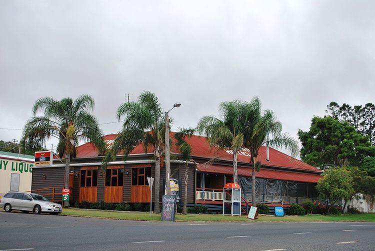
The town is named for the local Indigenous Australian word for wattle tree. The Tingoora Hotel, established in 1900, was reportedly the first public building in the town.
References
Tingoora, Queensland Wikipedia(Text) CC BY-SA