
Country Philippines Founded 1890 Time zone PST (UTC+8) Mayor Mark Laurence F. Alvarez | District 2nd District Barangays Area 33.07 km² Local time Saturday 10:33 PM | |
 | ||
Region Calabarzon (Region IV-A) Weather 25°C, Wind E at 11 km/h, 90% Humidity | ||
Tingloy, officially the Municipality of Tingloy (Filipino: Bayan ng Tingloy), is a municipality in the province of Batangas in the Calabarzon (Region IV-A) of the Philippines. The population was 17,919 at the 2015 census. In the 2016 electoral roll, it had 11,079 registered voters.
Contents
Map of Tingloy, Batangas, Philippines
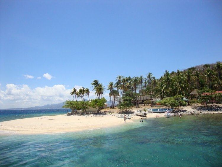
The municipality comprises Maricaban Island, Caban Island, and other minor islets, all just south of the Calumpang Peninsula. Visitors to its beaches and diving facilities are a source of income.
History
The name "Tingloy" was, according to legend, derived from a plant of almost the same name, "tinghoy", which is no longer found in abundance on the island.
The first people to inhabit the island almost a century ago came from Taal and Bauan, presumably to escape the brutalities perpetrated by the Spanish "conquistadors". They came in family groups and finding the place a haven, settled down in definite areas later forming the various barrios now comprising the created political subdivision. It is said that the former barrio of Tingloy was founded by Jose Martinez, a Taaleño.
At several times the island was placed under the jurisdiction of different towns. The island was originally part of the town of San Luis. In 1917, it was placed under the jurisdiction of Bauan, only to be separated from it a year later when the municipality of Mabini was formed. In 1921, it was again placed under the jurisdiction of Bauan.
During the Spanish regime, people were educated at home learning to read the "Cartillas" and the "Caton" "Christiana". During American occupation schools were established. Ireneo Martinez together with Flaviano Gamben, initiated a movement for a model schoolhouse for the former barrio of Tingloy. This movement was became a success when a model schoolhouse was constructed in the present poblacion of the Municipality of Tingloy sometime in 1921.
During the second Regular Session of the third Congress of the Republic of the Philippines, the barrios of Tingloy, Maricaban, Payapa, Pisa, Gamao, and Talahib were separated from the Municipality of Bauan and constituted into the newly created municipality of Tingloy. President Ramon Magsaysay, on June 17, 1955, appointed the first municipal Officials headed by Ramon De Claro as Mayor.
Geography
Tingloy is located at 13°39′N 120°52′E.
According to the Philippine Statistics Authority, the municipality has a land area of 33.07 square kilometres (12.77 sq mi) constituting 1.06% of the 3,119.75-square-kilometre- (1,204.54 sq mi) total area of Batangas.
Just off the southwest coast of the Batangas mainland, about two nautical miles (3.7 kilometres) south, lies the radish-shaped island of Maricaban. It has a land area of about 14 square miles (36 square kilometres) of rugged hills and sloping mountains with occasional lowland plains and valleys.
Barangays
Tingloy is politically subdivided into 15 barangays.
Demographics
In the 2015 census, Tingloy had a population of 17,919. The population density was 540 inhabitants per square kilometre (1,400/sq mi).
In the 2016 electoral roll, it had 11,079 registered voters.