
Population 153 (2006 census) Elevation 566 m Lga Central Desert Region | Time zone ACST (UTC+9:30) Local time Saturday 1:10 AM Federal division Division of Lingiari | |
 | ||
Location 1,305 km (811 mi) from Darwin
195 km (121 mi) from Alice Springs Weather 18°C, Wind SE at 14 km/h, 25% Humidity | ||
Ti Tree is a small town in the Northern Territory along the Stuart Highway 193 km north of Alice Springs, 311 km south of Tennant Creek and 1289 km south of Darwin in Australia. At the 2006 census, Ti Tree had a population of 153.
Contents
Map of Ti Tree NT 0872, Australia
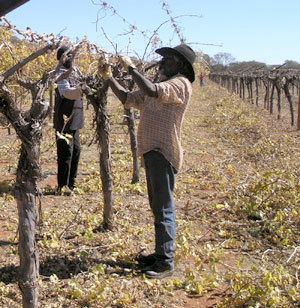
It is the closest town to Alice Springs. The area around Ti Tree has a population of 995 people of whom 191 are non-Aboriginal. The population is distributed between the 11 cattle stations, 6 Aboriginal outstations including Utopia, Ti Tree township, Barrow Creek community and the agricultural produce farms of Ti Tree Farm, Central Australian Produce Farm and the Territory Grape Farm. The area is an emerging centre for grapes and melons due to its year-round sunshine and abundant underground water supply. A famous landmark just to the north of Ti Tree is Central Mount Stuart.
History
The Anmatyerre name for the area close to Ti Tree township is Aleyaw but no one seems to know how or where the name Ti Tree or Tea Tree came from. One of the first features in the area to be named was Ti Tree Well No. 3 (still to be seen on the western side of the highway just south of the township) which was developed during the construction of the Overland Telegraph Line.
The remains of Ti Tree Well No. 2 can be found at the southern end of the air strip.
In 1888 an area of about 64 km incorporating the well was formally set aside as the Tea Tree Telegraph Reserve and in 1919 W. J. 'Bill' Heffernan was granted a lease to a parcel of land which he called Tea Tree Station. The current station covers an area of 3584 km².
Since the construction of the Overland Telegraph Line Tea Tree Well had become known for its good supply of sweet water but this was not enough to make Heffernan's labours financially rewarding. By 1935 the run was poorly improved with primitive buildings and no horse or bullock paddocks. Heffernan died in Alice Springs in 1969 and the station was carried on by his widow.
In 1975 Ian Dahlenberg took up 640 acres (2.6 km2) of the station and established Dahlenberg Horticultural Enterprise which now grows grapes and watermelons on Ti Tree Farm.
Ti Tree Station was sold to the Aboriginal Land Fund Commission in 1976 and became a subject of a land claim on behalf of the local Aboriginal people. Much of the area surrounding Ti Tree township is now within the bounds of the Ahakeye Land Trust, Aboriginal Freehold Lease.
Current
Ti Tree is the first substantial stop heading north from Alice Springs and is the largest community between Alice Springs and Tennant Creek. There is a hotel, a school and a police station along with several other buildings. Petrol and other traveller facilities are available.
Much of the land surrounding Ti Tree is Aboriginal land, owned by the Anmatyerre people. Their art can be viewed within the town and there are several interesting sites in the area surrounding the township. The town serves as a service town to surrounding Aboriginal Communities.
Ti Tree is the centre for a vegetable producing area, producing fresh vegetables and fruit for Territory markets, with an annual table-grape harvest alone reaps $10 million.