
Population 198 (2011) Sovereign state United Kingdom Local time Friday 2:39 AM | OS grid reference TF167966 | |
 | ||
Weather 14°C, Wind SE at 19 km/h, 75% Humidity | ||
Thoresway is a village and civil parish in the West Lindsey district of Lincolnshire, England. It is 1.5 miles (2.4 km) west from the B1225 road, 4 miles (6.4 km) southeast from Caistor and 6 miles (10 km) north-east from Market Rasen. The population (including Kirmond le Mire and Stainton le Vale) was 198 at the 2011 census.
Map of Thoresway, Market Rasen, UK
Thoresway is recorded in Domesday Book as "Toreswe", and listed as having 62 households and two mills. In an 1187 Gilbertine charter it was listed as "Toresweie". The name may derive from:-
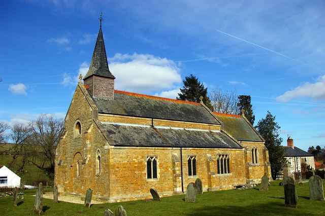
The parish church is a Grade II listed building dedicated to Saint Mary and dating from the 12th century, although it was largely rebuilt between 1879 and 1886 by James Fowler of Louth. It was built of ironstone and limestone and has a 12th-century font.
Also in the village is a Grade II listed watermill dating from 1816.