
Country United States FIPS code 36-73627 Elevation 450 m Local time Thursday 8:27 PM | State New York Time zone Eastern (EST) (UTC-5) GNIS feature ID 0979543 Population 15,308 (2010) | |
 | ||
Weather 4°C, Wind E at 11 km/h, 50% Humidity Area 226.4 km² (217.8 km² Land / 8.547 km² Water) Points of interest Holiday Mountain, Family Fun Farm, Town of Thompson Town Park | ||
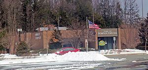
Thompson is a town in Sullivan County, New York, United States. The population was 15,308 at the 2010 census. The town is named after William Thompson, an early settler.
Contents
Map of Thompson, NY, USA
The Town of Thompson is in the southeast part of the county. Sullivan County Community College is located nearby in Loch Sheldrake, an unincorporated hamlet in the adjacent Town of Fallsburg.
History
The town was first settled in 1749. The town was established in 1803 from the Town of Mamakating. Part of the town was taken from the Town of Fallsburg in 1826.
Geography
According to the United States Census Bureau, the town has a total area of 87.4 square miles (226 km2), of which, 84.1 square miles (218 km2) of it is land and 3.3 square miles (8.5 km2) of it (3.77%) is water.
Demographics
As of the census of 2000, there were 14,189 people, 5,543 households, and 3,481 families residing in the town. The population density was 168.7 people per square mile (65.1/km²). There were 9,258 housing units at an average density of 110.1 per square mile (42.5/km²). The racial makeup of the town was 73.70% White, 16.94% African American, 0.18% Native American, 1.85% Asian, 0.03% Pacific Islander, 4.64% from other races, and 2.67% from two or more races. Hispanic or Latino of any race were 14.56% of the population.
There were 5,543 households out of which 30.0% had children under the age of 18 living with them, 42.4% were married couples living together, 15.2% had a female householder with no husband present, and 37.2% were non-families. 30.6% of all households were made up of individuals and 11.3% had someone living alone who was 65 years of age or older. The average household size was 2.44 and the average family size was 3.04.
In the town, the population was spread out with 26.0% under the age of 18, 7.4% from 18 to 24, 26.8% from 25 to 44, 25.5% from 45 to 64, and 14.2% who were 65 years of age or older. The median age was 38 years. For every 100 females there were 97.0 males. For every 100 females age 18 and over, there were 94.0 males.
The median income for a household in the town was $35,511, and the median income for a family was $41,043. Males had a median income of $37,759 versus $26,692 for females. The per capita income for the town was $18,668. About 18.3% of families and 23.3% of the population were below the poverty line, including 34.9% of those under age 18 and 13.4% of those age 65 or over.