
Location United Kingdom Criteria i, ii, iii Inscription 1986 (10th Session) | Type Cultural Reference 373 | |
 | ||
UNESCO region Europe and North America | ||
The Sanctuary is a prehistoric site on Overton Hill located around 5 miles west of Marlborough in the English county of Wiltshire.
It is part of a wider Neolithic landscape which includes the nearby sites of Silbury Hill, West Kennet Long Barrow and Avebury, to which The Sanctuary was linked by the 25m wide and 2.5 km long Kennet Avenue. It also lies close to the route of the prehistoric Ridgeway and near several Bronze Age barrows.
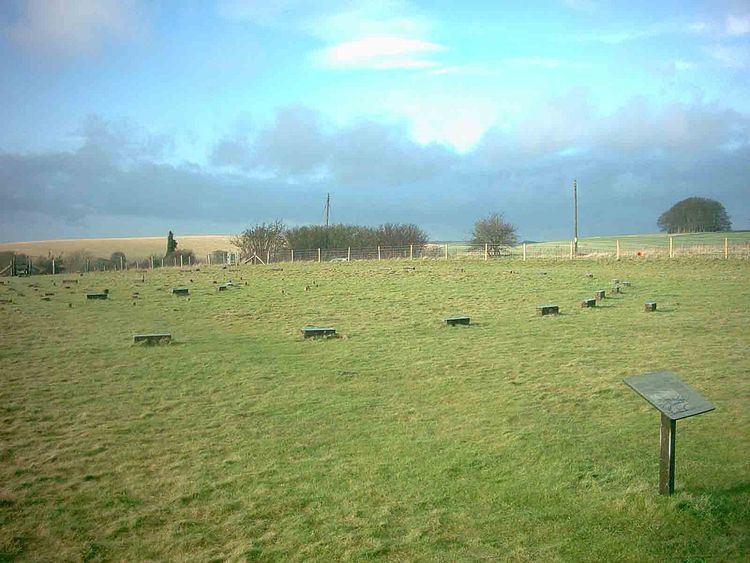
The first stage of activity at the site consisted of six concentric rings of timbers erected around 3000 BC. When the site was first excavated by Maud and Ben Cunnington in 1930, they were interpreted as a timber equivalent to Stonehenge. 162 postholes were excavated, some with double posts and the remains of postpipes still visible. Later interpretations have made much of The Sanctuary's link with Avebury via the Avenue and suggested that the two sites may have served different but complementary purposes. The timbers may have supported a roof of turf or thatch and been a high status dwelling serving the ritual site at Avebury, although this can only be conjectural. Another interpretation is that it served as a mortuary house where corpses were kept either before or after ritual treatment at Avebury. Neolithic pottery and animal bone were recovered by the Cunningtons, indicating that the site saw some degree of occupation activity. Recent excavation by Mike Pitts has given greater credence to the Cunningtons' original interpretation of freestanding posts.
What was probably a series of three increasingly large timber structures was eventually superseded around 2100 BC by two concentric stone circles of different diameters and numbers to the preceding timber circles. Stuart Piggott has suggested that the stones stood within the third larger contemporary timber building. The Cunningtons excavated Beaker items from this phase including the remains of an adolescent interred with a pot.
The site was largely destroyed in 1723 although not before William Stukeley was able to visit and draw it. Stukeley considered the stones at The Sanctuary to represent the head of a giant pagan serpent marked out by the Kennet and Beckhampton Avenues.
The Sanctuary is open to the public, with concrete posts used to mark the positions of the stones and timbers.
Michael Dames (see References) put forward a composite theory of seasonal rituals, in an attempt to explain the Sanctuary and its associated sites (West Kennet Long Barrow, the Avebury henge, Silbury Hill and Windmill Hill).
LocationEdit
The Sanctuary is located at Ordnance Survey mapping six-figure grid reference SU 118679