
Opened 18 April 2005 Construction end 18 April 2005 | ||
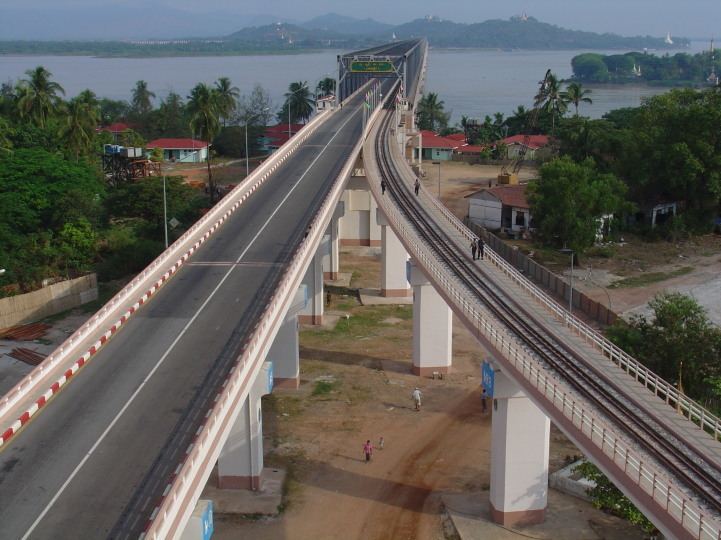 | ||
Carries 2 lanes (SB and NB), 1 rail track (14 ft), 2 sidewalks(6 ft each) Crosses Salween River via Shampoo Island Official name Thanlwin Bridge, (Mawlamyaing) Maintained by Ministry of Transportation Bridge type Truss bridge, Cantilever bridge Similar Attaran Bridge, Mawlamyine Railway Station, Mon State Cultural Museum, Irrawaddy Bridge, Kizuna Bridge | ||
Thanlwin Bridge (Mawlamyaing) is the longest bridge in Burma, and connects the city of Mawlamyaing with Mottama. Constructed at the confluence of the Thanlwin River, the Gyaing River and the Attayan River in Mon State, the bridge has a two-mile (3 km)-long motor road and four-mile (6 km)-long railroad as well as pedestrian lanes.
The approach structure of the rail bridge on Mawlamyaing bank is 1.22 miles (1,960 m) long, and on Mottama bank is 1.42 miles (2,290 m) long. The total length of the rail bridge is 4.1 miles (6,600 m) long. The bridge was designed and built by Ministry of Construction.
References
Thanlwin Bridge (Mawlamyine) Wikipedia(Text) CC BY-SA