
Country Vietnam University Hong Duc University Founded 1994 | Province Thanh Hoa Province Area 146.77 km2 | |
 | ||
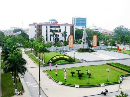
The city of Thanh Hóa ([tʰan hwǎː]) is the capital of Thanh Hóa Province. The city is situated in the east of the province on the Ma River (Sông Mã), about 150 kilometers (93 miles) south of Hanoi and 1560 kilometers (969 miles) north of Ho Chi Minh City. Thanh Hoa became one of the most populous cities in North Central Coast after expanding in 2012, with a population of approximately 400,000. Thanh Hoa township was upgraded to Thanh Hoa City in 1994 and has been center of politics, economy, culture, education and entertainment of Thanh Hóa Province for a long time.
Contents
- Map of Thanh Ha
- Overview
- History
- Topography
- Temperature
- Monsoon
- Rainfall
- Administrative Subdivision
- Economy
- Transportation
- References
Map of Thanh-Hóa
Overview
Thanh Hoa is a new developing city although its central position had established for long time ago. Nowadays, provincial administrators are trying to build and gentrification the city so that emphasis important role for the whole province and even North Central Coast.
History
The Thanh Hóa town and region were an area of popular support for Lê Lợi and the Lê dynasty in the 1580s, leading to the reestablishment of the southern court near the town following the withdrawal of Ming dynasty armies. After 1945 the city was a stronghold of the Viet Minh. In January 1946 the Viet Minh transported all local cells of the VNQDD to the city. During the Vietnam War, US strategic bombing destroyed much of the buildings and infrastructure, the whole city has been totally rebuilt since then.
Topography
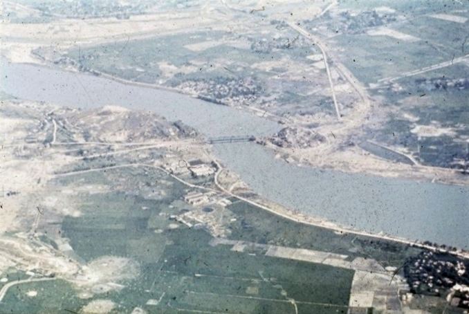
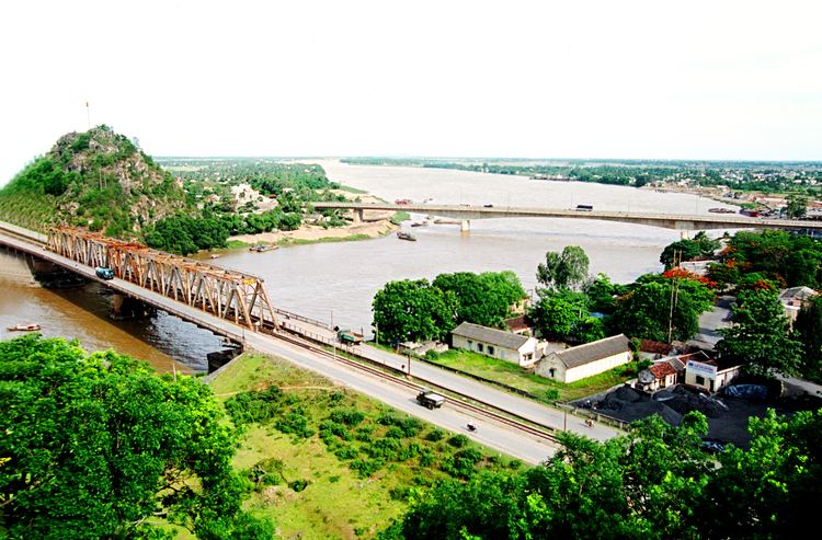
Thanh Hoa city is located in centre of Thanh Hoa's plain with many scattered rocky mountains surround. There are two main mountains along the city: Hàm Rồng and Mật Sơn. Hàm Rồng mountain begins from Thiệu Dương commune, which is about 8 km from city centre, along the right bank of the Ma River to Hàm Rồng Thanh Hóa Bridge pier. Ham Rong mountain has 99 peaks and had become an entrench for air defensive in Operation Rolling Thunder. Ma River is the longest river flow through the city, meandering around Ham Rong mountain before flowing to South East Asian sea. In addition, there are 5 canals were dug in order to support for watering, drought and flooding.
Temperature
In region of tropical monsoon climate, Thanh Hoa city has four seasons with two distinctive hot and cold atmospheres in a year.
Annual temperature is between 23.3 °C and 23.6 °C.
Monsoon
Thanh Hoa city is located in coast region so it is affected by three seasonal winds, which are mainly referred to distinctive wind directions.
Rainfall
Annual rainfall average is 1730 – 1980 mm.
Administrative Subdivision
By the time 2012, Thanh Hoa city had 12 inner wards and 6 outer communes. After expansion in February 2012, the city merged some subdivisions from other nearby districts and that extended total of urban subdivisions up to 37. Thanh Hoa city currently has 20 inner wards and 17 outer communes.
Note: Area: km2; Density: People/km2 (Statistics in 2009)
After expansion, Thanh Hoa city's population had rise up from 207,698 to 406,550 people (2014). According to urban development plan in 2012, the estimated population will be approximate 1 million in 2030 with 800,000 urban people.
Economy
According statistic in 2013, GDP sector composition of the city's economy:
Annual economic growth rate is 15% (2013). Total of capital development fund estimated 12,665 thousand billion VND (~650 million USD), export volume estimated 504 million USD. State budgets revenue is 1,436 thousand billion VND(~70 million USD). GDP per capital is 3,930 USD.
Currently, there are three industrial regions locally:
Transportation
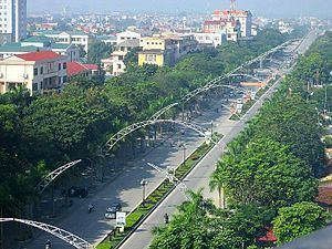
As central position of province, Thanh Hoa city is the heart of transport network, where every essential transportation modes are aggregated such as North–South Railway (Vietnam), National Route 1A (Vietnam), National Route 47, buses system and many other provincial routes.
Le Mon port is situated beside Ma River and 4 km from city centre east. This river port supports and provides transportation for Le Mon industrial region.
In February 2013, Tho Xuan Airport, which is located 45 km to the east from city, was implemented and upgrade to turn into a mixed civilian/military airport. This airport became the place provide air transport services for Thanh Hoa city.