
Country Burma District Mawlamyine District Time zone MST (UTC+6.30) | Division Mon State Township Thanbyuzayat Township Local time Thursday 7:36 PM | |
 | ||
Weather 29°C, Wind SW at 8 km/h, 64% Humidity | ||
Thanbyuzayat (Burmese: သံဖြူဇရပ်မြို့; Mon: ဇြပ်ဗု Tin Shelter) is a town in the Mon State of south-eastern Myanmar. It is the administrative center for Thanbyuzayat Township. Thanbyuzayat is about 64 kilometres (40 mi) south of Mawlamyine (Moulmein) and 24 kilometres (15 mi) miles south-east of Kyaikkami (Amherst).
Map of Thanbyuzayat, Myanmar (Burma)
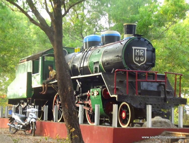
During World War II Thanbyuzayat was the western terminus of the Thailand–Burma Railway linking up with the pre-war coastal railway between Ye and Rangoon. Thanbyuzayat was also the site of a Japanese Prisoner of war camp for the prisoners who worked on building the railway, and over 3,000 Allied servicemen are buried there in the Thanbyuzayat War Cemetery. Today a clock tower stands at the central road junction with roads headed north to Mawlamyine, south to Ye, and west to Kyaikkami and Setse.