
Country United States County Bergen Named for Walter C. Teter Local time Wednesday 6:24 PM | State New Jersey Incorporated March 26, 1917 Zip code 07608 Population 71 (2013) | |
 | ||
Area rank 490th of 566 in state
62nd of 70 in county Weather 12°C, Wind N at 21 km/h, 32% Humidity Colleges and Universities Teterboro School of Aeronautics, Jersey College | ||
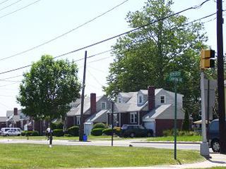
Teterboro (/tiːtɜːrbɜːroʊ/ TEE-tər-bər-o) is a borough in Bergen County, in the U.S. state of New Jersey. As of the 2010 United States Census, the borough's population was 67, reflecting an increase of 49 (+272.2%) from the 18 counted in the 2000 Census, which had in turn declined by 4 (−18.2%) from the 22 counted in the 1990 Census. As of 2010, it the fourth-smallest municipality, by population, in New Jersey.
Contents
- Map of Teterboro NJ USA
- History
- Geography
- 2010 Census
- 2000 Census
- Local government
- Federal state and county representation
- Politics
- Education
- Roads and highways
- Public transportation
- References
Map of Teterboro, NJ, USA
Teterboro is the home of Teterboro Airport (operated by the Port Authority of New York and New Jersey) which takes up most of the borough, along with portions of Hasbrouck Heights and Moonachie.
History
Teterboro was incorporated on March 26, 1917, from land taken from the boroughs of Moonachie and Little Ferry and from Lodi Township. The borough was enlarged on July 5, 1918, by the addition of an area annexed from Hasbrouck Heights. The name Teterboro was changed on April 14, 1937, to Bendix Borough, but changed back to Teterboro Borough on June 1, 1943. The borough was named for Walter C. Teter, a New York investment banker, who had purchased land in 1917 to build a racetrack and developed a 700-acre (280 ha) site, reclaiming marshland and building an airport and an 18-hole golf course.
In the past, neighboring municipalities, such as Hasbrouck Heights and South Hackensack, have attempted to dissolve Teterboro, in hopes of absorbing the town's ratables. Some people have reasoned that the population is too small for the borough to justify its own existence. However, all such attempts have met with failure, due to resistance from residents, business owners and municipal officials. In July 2010, a bill was introduced in the New Jersey state senate in a renewed effort to divide Teterboro among neighboring towns. The bill stalled in the state Legislature after its introduction, due to opposition from the borough as well as the neighboring municipalities of Moonachie and Hasbrouck Heights. The legality of a 20-year tax abatement proposed for Teterboro businesses within the bill, which had been included to alleviate concerns of property owners that taxes could spike if the borough was dissolved, was also called into question.
Geography
According to the United States Census Bureau, the borough had a total area of 1.158 square miles (3.000 km2), including 1.157 square miles (2.997 km2) of land and 0.001 square miles (0.003 km2) of water (0.08%).
The borough borders Hackensack, Hasbrouck Heights, Little Ferry, Moonachie and South Hackensack.
2010 Census
The 2010 United States Census counted 67 people, 25 households, and 13 families residing in the borough. The population density was 57.9 per square mile (22.4/km2). The borough contained 27 housing units at an average density of 23.3 per square mile (9.0/km2). The racial makeup of the borough was 67.16% (45) White, 4.48% (3) Black or African American, 2.99% (2) Native American, 2.99% (2) Asian, 0.00% (0) Pacific Islander, 8.96% (6) from other races, and 13.43% (9) from two or more races. Hispanics or Latinos of any race were 35.82% (24) of the population.
Out of a total of 25 households, 28.0% had children under the age of 18 living with them, 36.0% were married couples living together, 12.0% had a female householder with no husband present, and 48.0% were non-families. 32.0% of all households were made up of individuals, and 20.0% had someone living alone who was 65 years of age or older. The average household size was 2.68 and the average family size was 3.85.
In the borough, 23.9% of the population were under the age of 18, 6.0% from 18 to 24, 23.9% from 25 to 44, 32.8% from 45 to 64, and 13.4% who were 65 years of age or older. The median age was 43.5 years. For every 100 females the census counted 86.1 males, but for 100 females at least 18 years old, it was 96.2 males.
The Census Bureau's 2006–2010 American Community Survey showed that (in 2010 inflation-adjusted dollars) median household income was $78,571 (with a margin of error of +/- $31,104) and the median family income was $79,107 (+/- $46,857). Males had a median income of $72,031 (+/- $9,149) versus $24,286 (+/- $75,310) for females. The per capita income for the borough was $32,446 (+/- $14,230). About 0.0% of families and 13.4% of the population were below the poverty line, including 0.0% of those under age 18 and 100.0% of those age 65 or over.
Same-sex couples headed no households in either 2010 or 2000.
2000 Census
As of the 2000 United States Census there were 18 people, 7 households, and 4 families residing in the borough. The population density was 16.2 people per square mile (6.3/km2). There were 8 housing units at an average density of 7.2 per square mile (2.8/km2). The racial makeup of the borough was 83.33% White, and 16.67% from two or more races.
There were 7 households out of which 42.9% had children under the age of 18 living with them, 42.9% were married couples living together, 28.6% had a female householder with no husband present, and 28.6% were non-families. 14.3% of all households were made up of individuals and 14.3% had someone living alone who was 65 years of age or older. The average household size was 2.57 and the average family size was 3.00.
In the borough the population was spread out with 33.3% under the age of 18, 5.6% from 18 to 24, 50.0% from 25 to 44, 5.6% from 45 to 64, and 5.6% who were 65 years of age or older. The median age was 33 years. For every 100 females there were 100.0 males. For every 100 females age 18 and over, there were 100.0 males.
The median income for a household in the borough was $44,167, and the median income for a family was $43,750. Males had a median income of $18,750 versus $38,750 for females. The per capita income for the borough was $72,613. None of the population or families were below the poverty line.
Borough officials stated that the 2000 Census had failed to count any of the residents of the Vincent Place housing units who had moved into the newly built homes in 1999. The uncounted residents, including the Mayor and all four Council members, would help make up a projected tripling of the population enumerated by the census. Previously, the Mayor and Council, as well as several other Vincent Place residents, had all been residents of Huyler Street, the only other street zoned as a residential area in the borough. In a March 2010 article, published in The Record, Teterboro's municipal manager at the time noted that the actual population of the town had grown to approximately 60.
Local government
Teterboro is governed under the 1923 Municipal Manager Law form of New Jersey municipal government. The government consists of a Borough Council comprising five council members, with all positions elected at large in partisan elections to four-year terms on a concurrent basis. At a reorganization meeting held after each election, the Council selects one of its members to serve as mayor.
As of 2016, Teterboro's Borough Council consists of Mayor John P. Watt, James O'Dwyer, Juan Ramirez, Gregory Stein and John B. Watt, all serving concurrent terms of office ending June 30, 2018.
As of January 2016, the Moonachie Police Department assumed responsibility for all law enforcement services, which are provided under contract. From 2012 through 2015, the northern portion of the borough had been covered by the Bergen County Police Department, while the southern portion was covered by the Moonachie PD.
Federal, state and county representation
Teterboro is located in the 9th Congressional District and is part of New Jersey's 36th state legislative district. Prior to the 2011 reapportionment following the 2010 Census, Teterboro had been in the 38th state legislative district.
New Jersey's Ninth Congressional District is represented by Bill Pascrell (D, Paterson). New Jersey is represented in the United States Senate by Cory Booker (D, Newark, term ends 2021) and Bob Menendez (D, Paramus, 2019).
For the 2016–2017 session (Senate, General Assembly), the 36th Legislative District of the New Jersey Legislature is represented in the State Senate by Paul Sarlo (D, Wood-Ridge) and in the General Assembly by Marlene Caride (D, Ridgefield) and Gary Schaer (D, Passaic). The Governor of New Jersey is Chris Christie (R, Mendham Township). The Lieutenant Governor of New Jersey is Kim Guadagno (R, Monmouth Beach).
Bergen County is governed by a directly elected County Executive, with legislative functions performed by a seven-member Board of Chosen Freeholders. As of 2015, the County Executive is James J. Tedesco III (D, Paramus; term ends December 31, 2018). The seven freeholders are elected at-large in partisan elections on a staggered basis, with two or three seats coming up for election each year, with a Chairman, Vice Chairman and Chairman Pro Tempore selected from among its members at a reorganization meeting held each January. Bergen County's Freeholders are Freeholder Chairwoman Joan Voss (D, 2017; Fort Lee), Vice Chairman Steve Tanelli (D, 2015; North Arlington) Chairman Pro Tempore John A. Felice (R, 2016; River Edge), David L. Ganz (D, 2017; Fair Lawn), Maura R. DeNicola (R, 2016; Franklin Lakes) Thomas J. Sullivan Jr., (D, Montvale, 2015; serving the unexpired term of office that had been occupied by James Tedesco before he was sworn in as County Executive) and Tracy Silna Zur (D, 2015; Franklin Lakes). Countywide constitutional officials are County Clerk John S. Hogan (D, Northvale), Sheriff Michael Saudino (R) and Surrogate Michael R. Dressler (D, Cresskill).
Politics
As of March 23, 2011, there were a total of 39 registered voters in Teterboro, of which 12 (30.8% vs. 31.7% countywide) were registered as Democrats, 10 (25.6% vs. 21.1%) were registered as Republicans and 17 (43.6% vs. 47.1%) were registered as Unaffiliated. There were no voters registered to other parties. Among the borough's 2010 Census population, 58.2% (vs. 57.1% in Bergen County) were registered to vote, including 76.5% of those ages 18 and over (vs. 73.7% countywide).
In the 2012 presidential election, Democrat Barack Obama received 14 votes (58.3% vs. 54.8% countywide), ahead of Republican Mitt Romney with 9 votes (37.5% vs. 43.5%) and other candidates with one vote (4.2% vs. 0.9%), among the 24 ballots cast by the borough's 43 registered voters, for a turnout of 55.8% (vs. 70.4% in Bergen County). In the 2008 presidential election, Republican John McCain received 13 votes (52.0% vs. 44.5% countywide), ahead of Democrat Barack Obama with 12 votes (48.0% vs. 53.9%), among the 25 ballots cast by the borough's 34 registered voters, for a turnout of 73.5% (vs. 76.8% in Bergen County). In the 2004 presidential election, Democrat John Kerry received 14 votes (56.0% vs. 51.7% countywide), ahead of Republican George W. Bush with 8 votes (32.0% vs. 47.2%) and other candidates with 2 votes (8.0% vs. 0.7%), among the 25 ballots cast by the borough's 36 registered voters, for a turnout of 69.4% (vs. 76.9% in the whole county).
In the 2013 gubernatorial election, Republican Chris Christie received 55.6% of the vote (10 cast), ahead of Democrat Barbara Buono with 16.7% (3 votes), and other candidates with 27.8% (5 votes), among the 14 ballots cast by the borough's 36 registered voters for a turnout of 38.9%. In the 2009 gubernatorial election, Republican Chris Christie received 10 votes (50.0% vs. 45.8% countywide), ahead of Democrat Jon Corzine with 6 votes (30.0% vs. 48.0%) and Independent Chris Daggett with 3 votes (15.0% vs. 4.7%), among the 20 ballots cast by the borough's 35 registered voters, yielding a 57.1% turnout (vs. 50.0% in the county).
Education
The Hasbrouck Heights School District serves public school students in pre-kindergarten through twelfth grade from Hasbrouck Heights as well as those from Teterboro, a non-operating district that was merged into the Hasbrouck Heights School District following its dissolution on July 1, 2010.
Prior to July 2010, public school students in Kindergarten through eighth grade attended Memorial School in South Hackensack, as part of a sending/receiving relationship with the South Hackensack School District. High school students had an option to attend Hackensack High School of the Hackensack Public Schools, the receiving district for South Hackensack students, or Hasbrouck Heights High School. Teterboro students already enrolled in South Hackensack or Hackensack schools, prior to July 2010, were given the option to remain in those schools.
Public school students from the borough, and all of Bergen County, are eligible to attend the secondary education programs offered by the Bergen County Technical Schools, which include the Bergen County Academies in Hackensack, and the Bergen Tech campus in Teterboro or Paramus. The district offers programs on a shared-time or full-time basis, with admission based on a selective application process and tuition covered by the student's home school district.
Roads and highways
As of May 2010, the borough had a total of 4.65 miles (7.48 km) of roadways, of which 3.28 miles (5.28 km) were maintained by the municipality, 0.30 miles (0.48 km) by Bergen County and 1.07 miles (1.72 km) by the New Jersey Department of Transportation.
U.S. Route 46 travels east-west through Teterboro to the north of Teterboro Airport, while a small piece of Interstate 80 travels along the northern edge of the borough. Route 17 travels parallel to the Hasbrouck Heights – Teterboro border on the Hasbrouck Heights side.
Public transportation
Teterboro is served by NJ Transit at the Teterboro train station, located on Williams Avenue near Route 17. The station offers service on the Pascack Valley Line, which runs north-south to Hoboken Terminal with connections via the Secaucus Junction transfer station to New Jersey Transit one-stop service to New York Penn Station and to other NJ Transit rail service, and at Hoboken Terminal to other New Jersey Transit rail lines, the PATH train at the Hoboken PATH station, New York Waterways ferry service to the World Financial Center and other destinations and Hudson-Bergen Light Rail service.
NJ Transit provides bus service on the 161 (on Route 46), 164 and 165 routes to the Port Authority Bus Terminal in Midtown Manhattan, to Newark on the 76 route, with local service on the 772 route.