
Country Singapore Population 10 (2015) | Area 7 km² | |
 | ||
Town council Chua Chu Kang Town Council Mayor | ||
Tengah is a planning area and future HDB town located within the West Region of Singapore. It is bounded to by Choa Chu Kang to the northeast, Jurong East and Jurong West to the south, Bukit Batok to the east and the Western Water Catchment to its west and north.
Contents
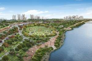
Map of Tengah, Singapore
Formerly a military restricted area, Tengah is currently reserved for future housing developments slated for completion by 2018, making it Singapore's newest Housing and Development Board town since the development of Punggol in the 1990s.
The southwestern portion of Tengah will be developed as part of the Jurong Innovation District, a newer industrial development compared to Jurong Industrial Estate.
Etymology
Before urbanization took place, the area known as Tengah today, was previously known as "Hong Kah", a Chinese kampong located just slightly north off present-day Jurong West. A neighbourhood of the same name within Jurong West, continues to retain this appellation.
It is not exactly clear when the name "Tengah" came in to popular use to describe the area. In Malay, the word Tengah means "centre", "central" or "middle".
History
In the 1980s, under the government's resettlement plan, villagers of Hong Kah were shifted to nearby towns newly built by the government, particularly into today's Jurong Green, Jurong Spring and Bukit Batok areas. Schools were shifted elsewhere and one example is Xingnan Primary School, which used to operate at a temple along 'Hong Kah Road' at the village. The HDB estates of Jurong Green and Jurong Spring are given the name 'Hong Kah', probably meaning that most of the villagers resettled there. When the village was cleared, the PIE and KJE projects started in the area and that led to the creation of 'Jurong West Avenue 2' and the expressway which brought about the rise of Jurong West New Town and Choa Chu Kang New Town. The western part became inaccessible to the public first in 1996 and was used by the military for training activities (which is west of Jurong Road Track 22), followed by the eastern part of Hong Kah (which is east of Jurong Road Track 22) in 2005.
Military use
The bigger part of the former Hong Kah Village was an SAF military training area until 10 November 2015. The military training around the area has since been shifted to Ama Keng Road. Massive construction and earthworks subsequently began in October 2015.