
Founded 1560 Time zone ECT (UTC-5) | Elevation 598 m (1,962 ft) Area 261.8 km² | |
 | ||
Demonym(s) Tenese / Tenense (spanish) Weather 23°C, Wind W at 5 km/h, 90% Humidity Points of interest | ||
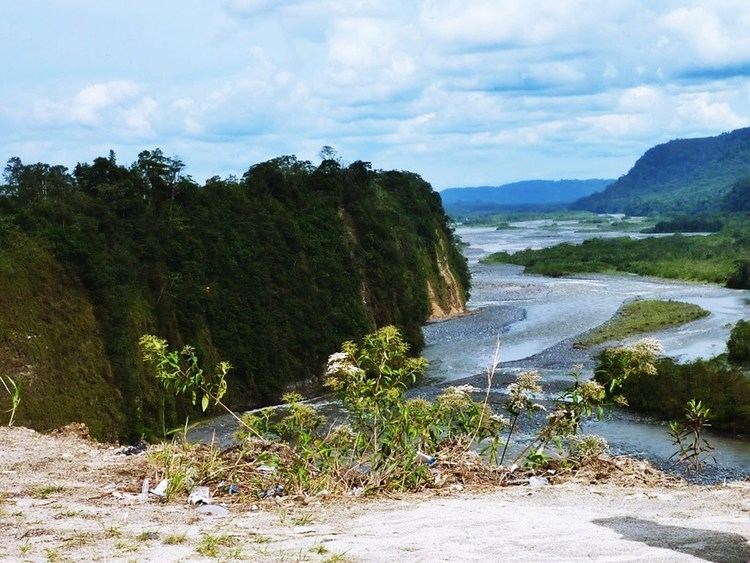
Tubing rio napo tena ecuador
Tena, the capital of the Napo Province, is a city in the Amazon rainforest. Known as the “cinnamon capital" of Ecuador, and founded by missionary explorers, Tena has emerged as a major commercial center of Ecuador. It is home to a regional hospital and many tourist related businesses, including a small airport and a vital bus terminal.
Contents
- Tubing rio napo tena ecuador
- Map of Tena Ecuador
- Cascada de lata tena ecuador
- Geography
- Climate
- Tourism
- Transportation
- Recreation
- See also
- References
Map of Tena, Ecuador
Cascada de lata tena ecuador
Geography
At the confluence of the Tena and Pano rivers in the center of town lies a popular pedestrian bridge, "el puente peatonal". The rivers become the Tena River, which soon joins with the Misahualli and eventually flows into the Napo River. The Napo winds its way south into Peru, and is in effect the 9th largest tributary to the Amazon River.
Climate
Tena is located in the rainforest, 420m above sea level. There is rainfall year-round, with an annual average of 171.65 inches (4,359.91 mm). The heaviest rains come in April, May, and June.
Tourism
Tena is a popular launching point for jungle, kayaking and rafting tours in Ecuador's Amazon rainforest region. The entry to the city is marked by a statue of the indigenous hero Jumandy, who led an uprising against the Spanish colonizers in 1578 and was subsequently executed.
The town is popular with tourists. Many inexpensive hotels, tourist agencies, and restaurants cater to backpackers who commonly use the town as a jumping-off point for trips into the rainforest. Tena is surrounded by forested hills and is located at the edge of the Andes, which are visible to the west.
Tena and its surrounding indigenous communities are also bases for many volunteers working for reforestation projects, with community support in development initiatives in diverse, and connected areas such as, ecotourism and capacity building. The indigenous populations of Ecuador are some of the most politically organized in Latin America, and Tena houses two major confederations, Fonakin (Federación de Organizaciones de la Nacionalidad Kichwa de Napo) and Ashin (Asociación de Shamanes Indígenas de Napo); one of the major stand-offs during the 2001 indigenous uprising in Ecuador, took place here.
Oil prospecting is a point of contention here, as there is drilling of the 250-square-mile (650 km2) Pungarayacu heavy oil field by Canadian corporation Ivanhoe.
Transportation
Most roads in the Oriente are unpaved and subject to landslides and other delays, especially during the rainy season. The road from Quito to Tena, however, is fully paved as of 2012, and it includes a spectacular passage over Papallacta Pass, above 4,000 m elevation. There is regular bus service over this road to Tena via Baeza. Small yellow truck-taxis are abundant in the city.
Around the time of the discovery of oil in the province, Mayor Galo de la Torre Airport was constructed to serve Tena. It closed in 2001. A new airport, Jumandy Airport located 27 km (17 mi) to the east near Ahuano, was inaugurated in 2011. The only airline that served it, TAME, ended flights to Tena in January 2016 citing low passenger loads.
Recreation
Tena is famous for the rainforest and rivers that surround it. It has some of the best rafting and kayaking in Ecuador. The jungle rivers on the Amazon side of the Andes are bigger and have more consistent flows than their west-Andean counterparts.