
 | ||
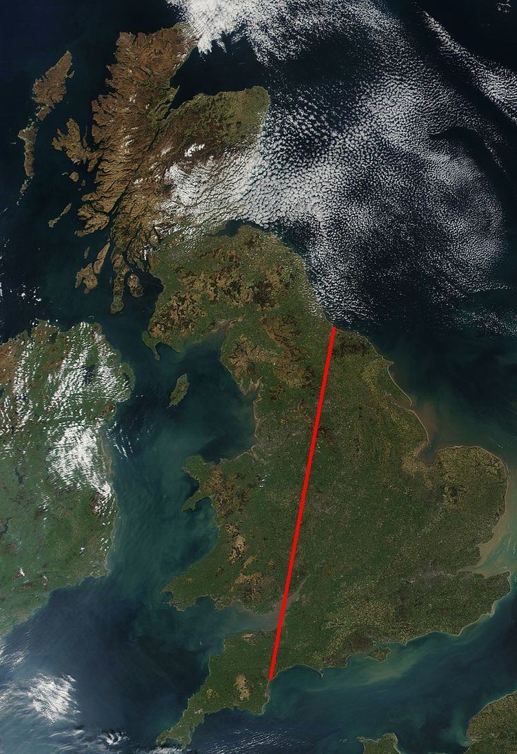
The Tees-Exe line is an imaginary northeast-southwest line that can be drawn on a map of Great Britain which roughly divides the country into lowland and upland regions.
The line links the mouth of the River Tees between Redcar and Hartlepool in the north east of England with the mouth of the River Exe in Devon in the south west. To the south and east of this line, the landscape, whilst not always flat is certainly lower and is characterised by flat-lying or gently tilted or folded sedimentary rocks. North and west of this line are the older, generally harder rocks including igneous and metamorphic rocks and the Palaeozoic and Precambrian sandstones and limestones which usually stand out as upland areas. The areas to the north and west of the line also have a generally wetter climate than areas to the east and south.
Other imaginary lines can be drawn, for similar purposes, between the Severn Estuary and the Wash, and between the Severn and the mouth of the River Trent. The Cross Country Route follows the line by railway along most of the length.