
Country United States ZIP codes 86514, 86535, 86544 Elevation 1,588 m Population 730 (2010) | Time zone MST (UTC-7) FIPS code 04-72560 Area 37 km² Area code 928 | |
 | ||
Teec Nos Pos (/tiːsˈnɒspɒs/; Navajo: T’iis Názbąs, [tʼiːsnɑ́sbɑ̃s]) is a census-designated place (CDP) in Apache County, Arizona, United States. The population was 730 at the 2010 census. The Navajo name of this community translates as "cottonwoods in a circle". It is the western terminus of U.S. Route 64.
Contents
- Map of Teec Nos Pos AZ 86514 USA
- Geography
- Demographics
- History
- Government and infrastructure
- Education
- References
Map of Teec Nos Pos, AZ 86514, USA
Geography
Teec Nos Pos is located at 36°55′23″N 109°5′18″W (36.923142, -109.088265).
According to the United States Census Bureau, the CDP has a total area of 14.3 square miles (37.0 km2), of which 0.012 square miles (0.03 km2), or 0.07%, is water.
Demographics
As of the census of 2000, there were 799 people, 227 households, and 182 families residing in the CDP. The population density was 56.1 people per square mile (21.7/km²). There were 317 housing units at an average density of 22.3/sq mi (8.6/km²). The racial makeup of the CDP was 96.50% Native American, 1.00% White, 0.13% from other races, and 2.38% from two or more races. 1.75% of the population were Hispanic or Latino of any race.
There were 227 households out of which 49.8% had children under the age of 18 living with them, 43.2% were married couples living together, 30.8% had a female householder with no husband present, and 19.8% were non-families. 16.7% of all households were made up of individuals and 5.7% had someone living alone who was 65 years of age or older. The average household size was 3.52 and the average family size was 4.02.
In the CDP, the age distribution of the population shows 41.3% under the age of 18, 8.9% from 18 to 24, 25.9% from 25 to 44, 18.1% from 45 to 64, and 5.8% who were 65 years of age or older. The median age was 25 years. For every 100 females there were 92.5 males. For every 100 females age 18 and over, there were 86.9 males.
The median income for a household in the CDP was $17,188, and the median income for a family was $27,083. Males had a median income of $21,023 versus $14,464 for females. The per capita income for the CDP was $6,229. About 41.5% of families and 43.8% of the population were below the poverty line, including 46.6% of those under age 18 and 78.9% of those age 65 or over.
History
The community of Teec Nos Pos was originally located several miles to the south of its present location, and was known as Tisnasbas, and so named officially by the U.S. Geological Survey in 1915.
The population has since moved north to the junction of U.S. Highways 160 and 64. In the 1930s, the Indian Irrigation Service constructed two concrete diversion dams on nearby T'iisnazbas Creek. The dams irrigated approximately 400 acres (1.6 km2) of Navajo farmland. It was renamed Teec Nos Pas in 1960 and Teec Nos Pos in 1983.
Teec Nos Pos is the closest settlement of any size to the Four Corners Monument, which is approximately 7 miles (11 km) to the northeast.
Government and infrastructure
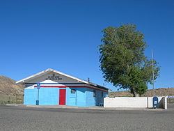
The United States Postal Service operates the Teec Nos Pos Post Office.
Education
The area is a part of the Red Mesa Unified School District. The city is served by Red Mesa K-8 School and Red Mesa High School.
Originally the territory was within the Chinle School District. In July 1983 the Red Mesa Unified School District formed, splitting from the Chinle School District.